Walking Tour
Historic Downtown
130 Years of Change
Andrew Farris
Abbotsford's historic downtown has undergone monumental changes over the last 130 years. Over the course of this tour we will see how the community has evolved, from a frontier railway town, to a regenerated shopping with historic shopfronts.
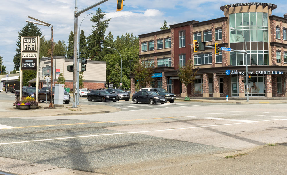
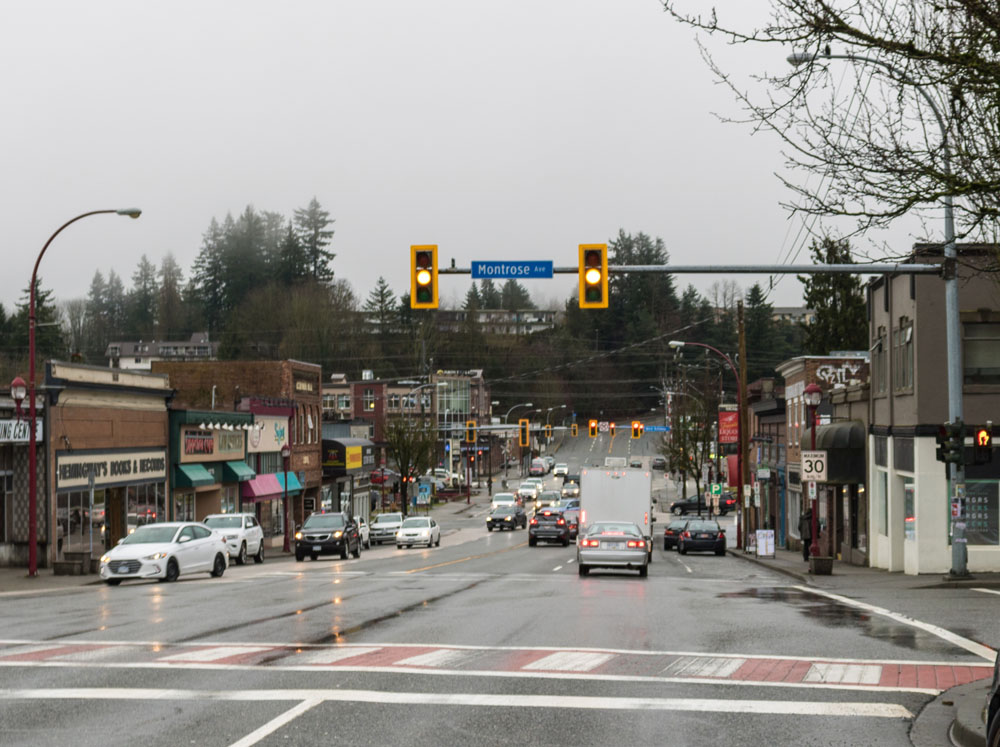
This tour starts on Essendene Avenue overlooking the historic townsite. Then we will proceed through the community, stopping by various historic buildings and learning many of the people, events, and ideas that have shaped this community.


This project is a partnership with Heritage Abbotsford and we owe them generous thanks for their support. This project was funded in party by the Heritage BC Legacy Fund.

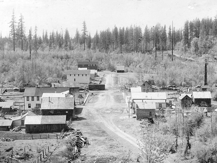
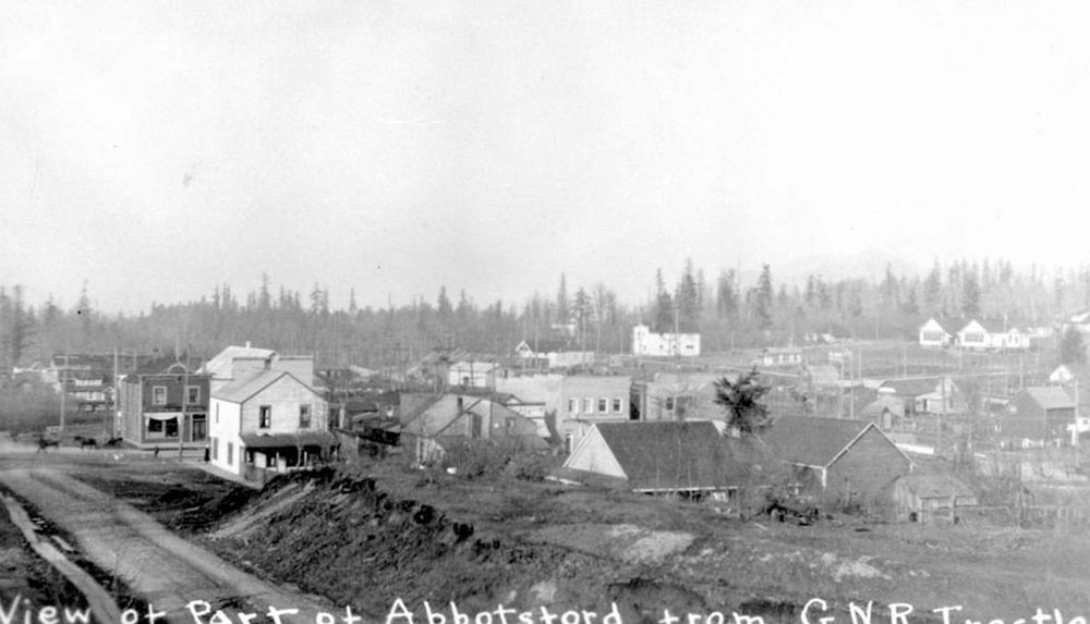
1. 130 Years of Change
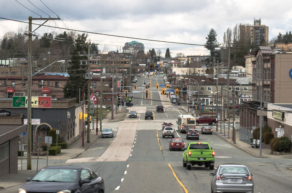
Vancouver Archives AM54-S4-: Out P754
1905
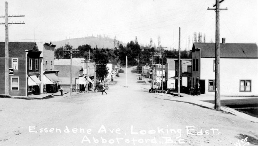
This is a relatively early view of the townsite of Abbotsford, taken about 15 years after its establishment in 1891. Most notably Essendene Avenue hasn't been straightened out yet, and terminates around where Montrose Street is today. Also notice how the ridge in the distance is shaped differently than it is today. That's because the railway trestle that would run where South Fraser Way is now has not been built yet. None of the wooden homes and businesses pictured here survive today.
Just a couple decades before this photo was taken, this area was entirely forested. The Stó:lō First Nation had lived on these lands for thousands of years, largely in harmony with their local environment. It only took a few decades of European settlement to bring about the dramatic changes you see here, and just over 100 years more to bring into being the city in front of you today.
2. Old Yale Road
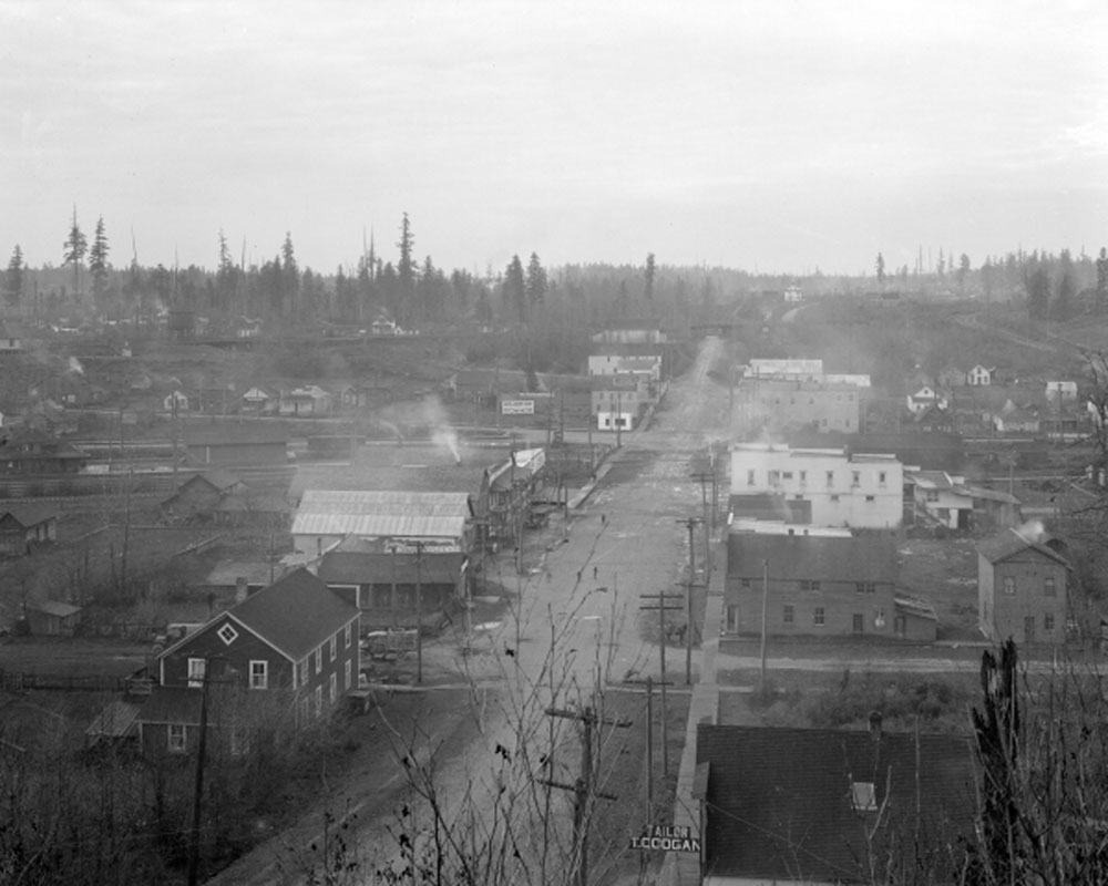
Vancouver Archives AM1535-: CVA 99 - 3260
1920
This photo was taken another 15 years later, from a slightly different perspective atop the bluff behind you. As you can see the townsite has grown considerably. There are many more streets and buildings with smoke puffing from their chimneys spreading over the town. In the distance you can see the railway trestle has been built, so that the downtown street layout is roughly in place.
The first major European inroads into this area came following the Fraser River gold rush in 1858. Word of gold caused 30,000 prospectors to stampede up the Fraser River Valley through this area, taking steamers as far upriver as they could. The Royal Engineers followed and cut a rough track through the Fraser Valley, all the way up to Yale. Completed in 1865, it was known as the Old Yale Road, and you're standing on part of it today. It ran where Essendene Ave is today, and up the hill you're standing on before winding up the valley. It was the first road into British Columbia's interior from the coast, and would shape the province's history.
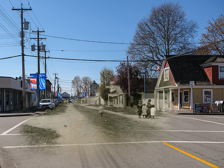
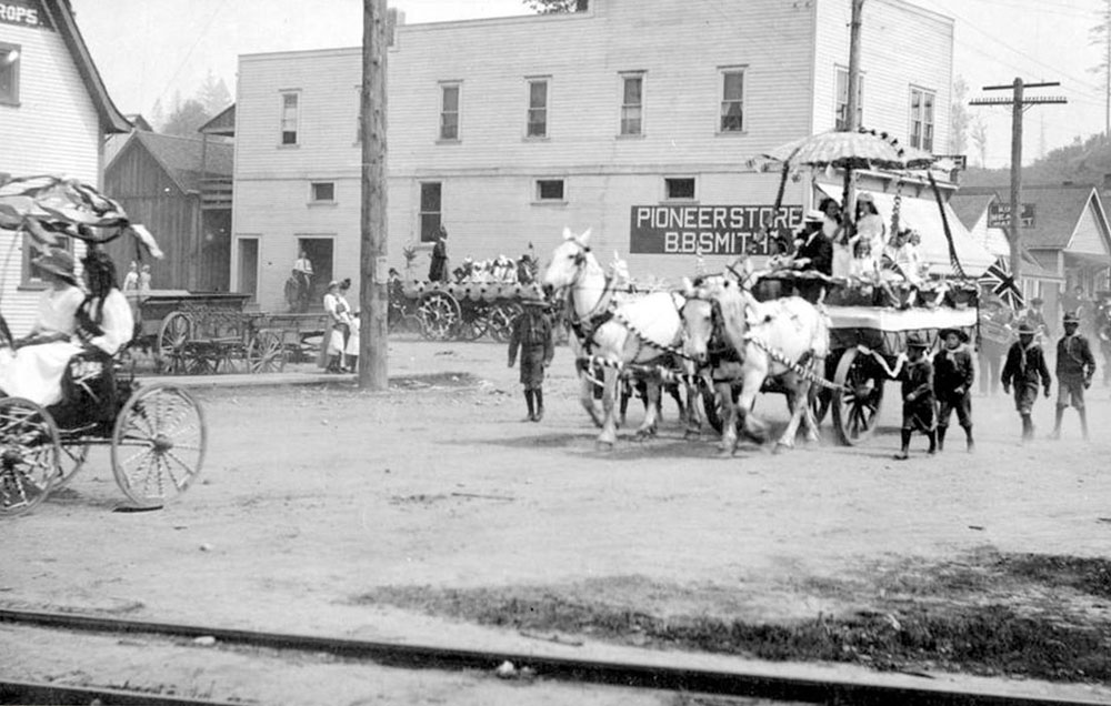
3. Abbotsford is Born
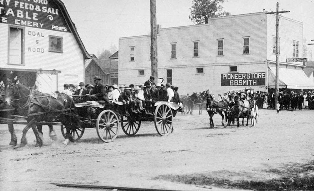
1915
Wagons carrying children ride past B.B. Smith's Pioneer Store during the town's May Day Parade. When this photo was taken the town clearly still had the feel of a pioneer town, yet it has grown considerably since its founding in 1891, as you can see from the substantial crowd that has come out to watch the parade.
Abbotsford began as a 160 acre plot of crown land granted to the Scottish Royal Engineer surveyor John Cunningham Maclure in 1889. When he chose this spot alongside the Old Yale Road, he declared it "the promised land." The Canadian Pacific Railway had completed its trans-continental railway just a few years earlier, and in 1891 they were looking to lay a new line from Mission down to the United States, and it was expected to run through this land.
For Robert Ward, who had bought the land earlier that year, this was a great opportunity. His condition for letting the railway through was that it must build a station here, which would inevitably lead to a town growing up around the station. When Ward asked Maclure what to name the new town, Maclure suggested naming it after his friend Harry Abbott, the Western Superintendent of the CPR. Abbotsford was born.
4. The Growing Village
1915
Another shot of parade floats turning onto Essendene Avenue, these ones more elaborately decorated carriages escorted by a troop of Boy Scouts. Notice the Union Jack flag, a reminder of Canada's strong ties to the United Kingdom long after Canadian Confederation in 1867.
After the arrival of the first railway through Abbotsford in 1891, a townsite was laid out that encompasses most of what we know today as the historic downtown. Abbotsford itself was incorporated as a village the next year, but its territorial boundaries were much smaller than they are today. Sumas and Matsqui were founded as separate districts, and they would eventually be amalgamated into Abbotsford in 1972 and 1997 respectively.
The railway brought in many settlers, mostly British immigrants, along with labourers from India, China, and Japan, who worked in the nearby farms. Indeed, the oldest surviving Sikh Temple in North America, the Gur Sikh Temple, was built in 1911 for Indian immigrants just a few blocks west of here on Fraser Way.
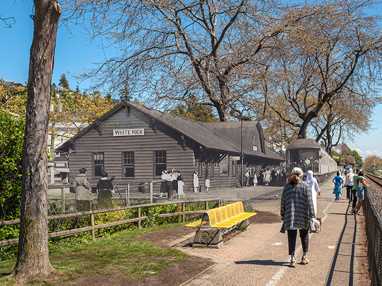
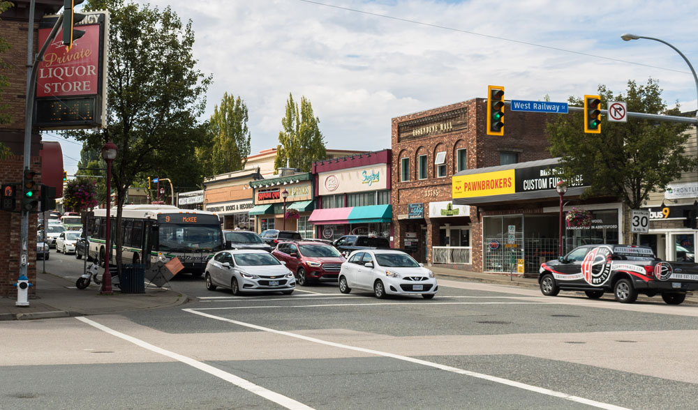
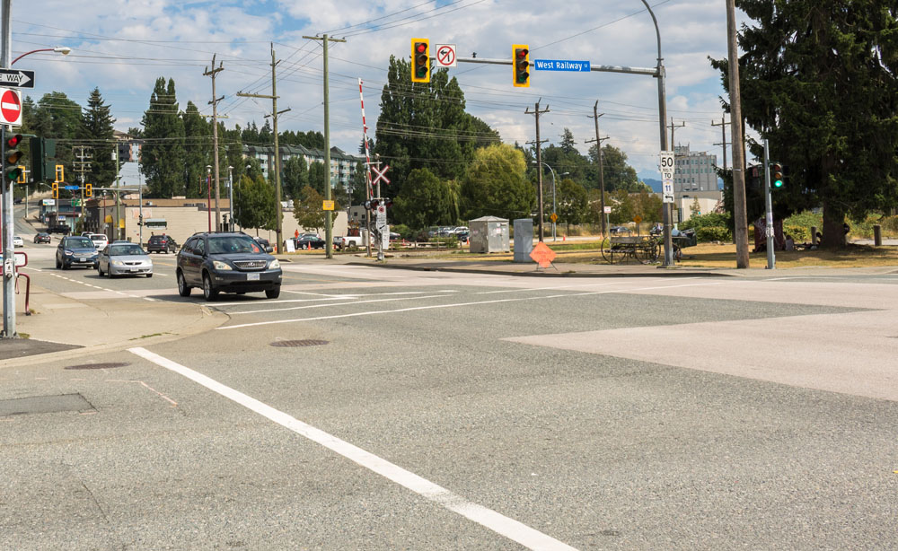
5. Railways and More Railways
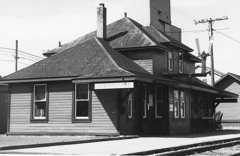
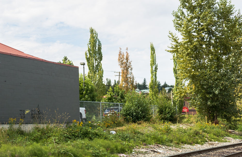
1955
Use caution when visiting this stop, as it's located a few metres down active railway tracks.
This is the former site of the Canadian Pacific Railway station around which the town grew. The station has not survived to the present.
Abbotsford was strategically located in the Fraser Valley at the crossroads of routes connecting Vancouver with BC's Interior and Seattle in the United States. In fact this line you're standing on was the only rail link between Vancouver and Seattle from 1891 to 1904. Many more were soon to follow.
In the leadup to the First World War, Canada had caught railway building fever, and Abbotsford's location put it right at the centre of this track-laying spree. In 1909 the Vancouver, Victoria and Eastern Railway laid tracks through the town. In 1910 came the BC Electric Railway, providing regular passenger service to Vancouver. In 1913 the Great Northern came through Abbotsford, and then the Canadian National Railway in 1915. Railways were criss-crossing Abbotsford heading to all points of the compass, and in addition to connecting Abbotsford to the outside world, they provided work to hundreds of Abbotsford men who laid and maintained the tracks.
6. Car Culture
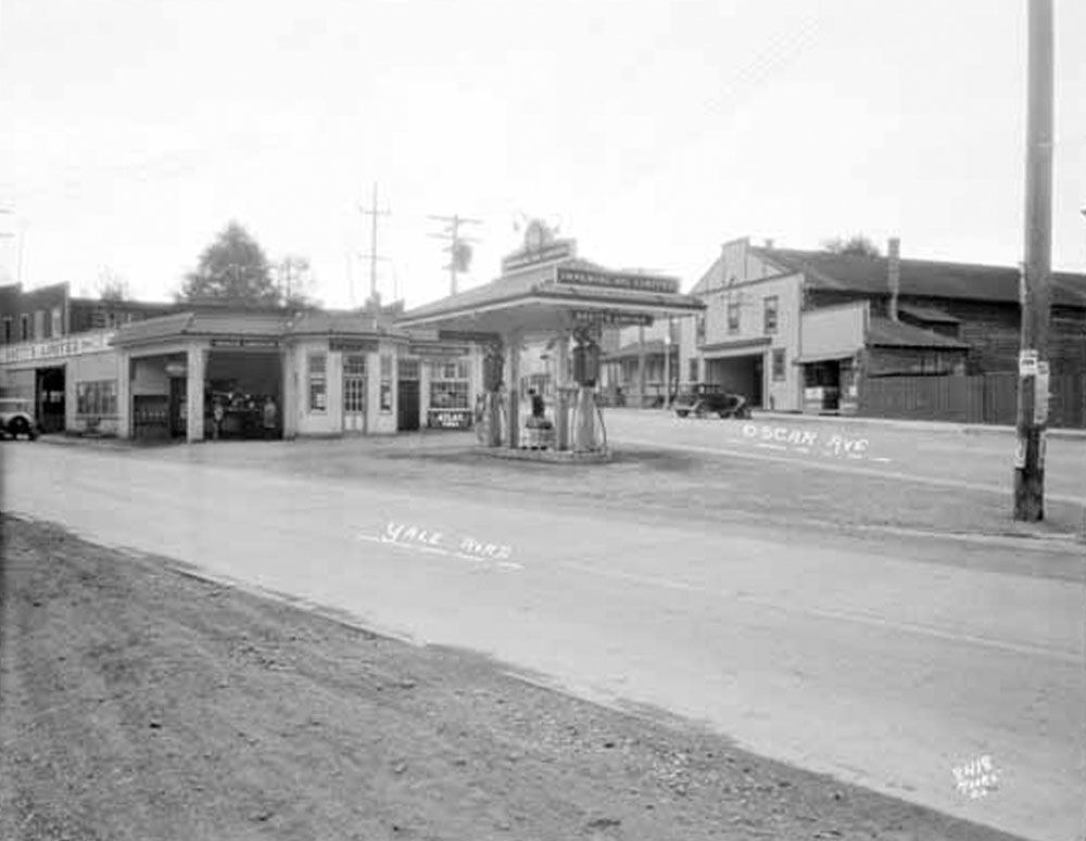
Vancouver Public Library Archives
1933
The Imperial Oil gas station was once located at this intersection. Notice most of the buildings in the background still survive in somewhat modified form. The appearance of this gas station is indicative of the wider trend away from horses and trains in the 1910s and 1920s, and towards personal car ownership.
Just at the time most of the new railway expansion was happening in Abbotsford in the early 1910s, odd mechanical contraptions were beginning to appear in the town: cars. Initially they were thought of as playthings for the rich, but as the price came down and people became more used to them, they rapidly grew in popularity.
By the 1920s cars clogged the roads, while horses were becoming a rare site on them. Gradually, businesses in Abbotsford catering to horses, like the livery stables we noticed a couple stops ago, were replaced by car dealerships and gas stations. It wasn't until after World War II that cars would completely eclipse horses and passenger trains in everyday use in Abbotsford, but it's a dominant position they've retained ever since.
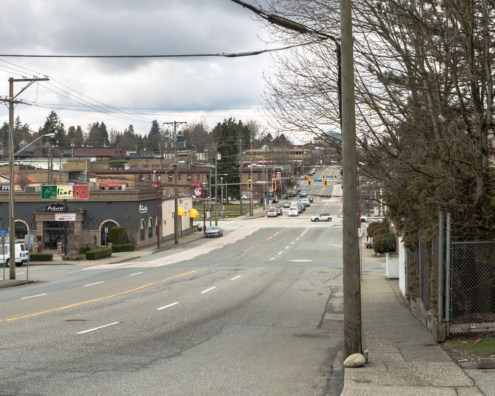
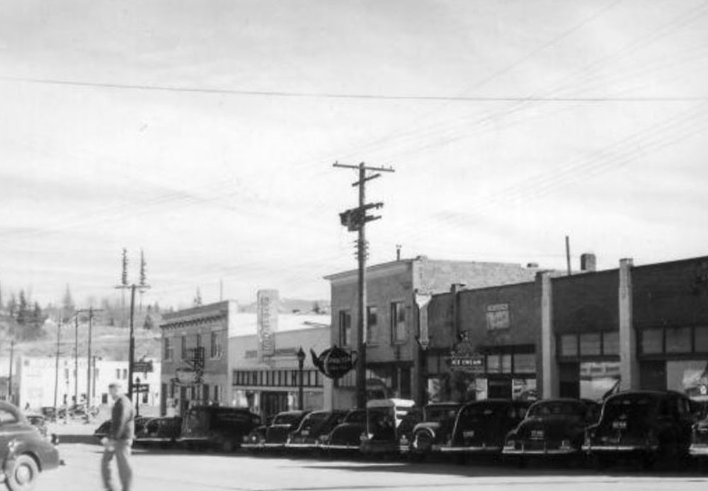
7. Essendene Ave.
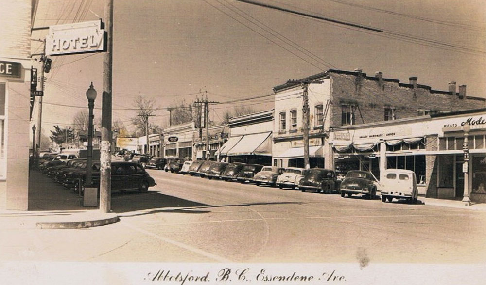
1940s
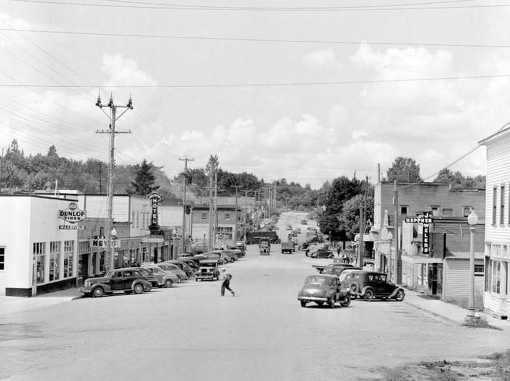
A view of Essendene Avenue in the 1940s. The street we know today has taken shape, with a number of historic buildings that survive to the present. Most prominent is the two-storey building at the centre right, the Copping Block, a historically significant building known today as the Essendene Mall. The Copping Block was completed in 1909 and housed a variety of businesses as well as hall upstairs for gatherings. In 1919 for the Great War Veterans Association (which we today know as the Legion).
These substantial buildings brought prestige to the town's merchants and gave downtown Abbotsford a sense of permanence. Not all these buildings survive today though: The Gazeley Block was another two-storey brick building and was located just to the right of the Copping Block. It burned down and was replaced with the one-storey building you see in the historic photo.
8. Fraternal Parade
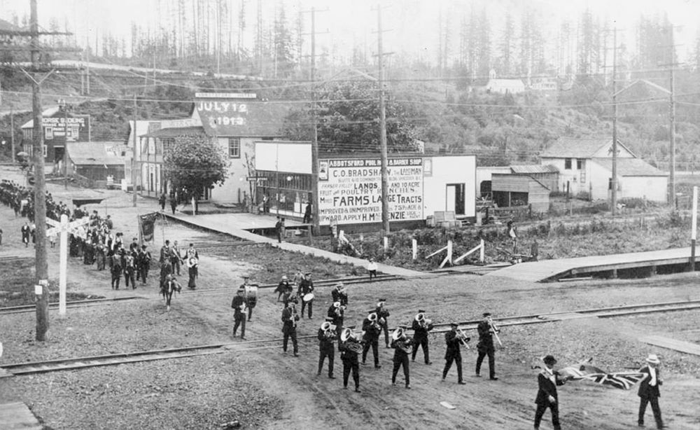
1913
A band marches down Essendene Avenue. Judging by the costumes and banners held aloft, these are members of a fraternal organization, such as the freemasons or the Fraternal Order of Eagles. These types of clubs were very popular at the time to help bind the young community together at a time when exceedingly few people had actually lived there for more than a few years.
Notice the roads are not yet paved. Paving of roads wasn't common until the 1930s, when car owners lobbied for them. Note that the original photo was taken from the second storey of the Gazeley Block, which has since burned down.
9. Clayburn Brickworks
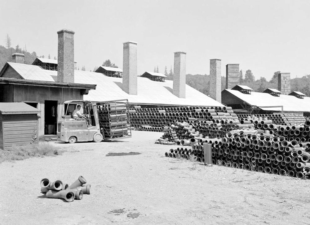
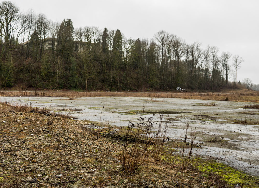
1951
From 1949 to 2011 this was the site of the Clayburn Brickworks manufacturing plant. This industry has a long history in Abbotsford, stretching back to 1905 when John Charles Maclure, son of the surveyor we met earlier in the tour.
He discovered remarkably high quality fireclay on Sumas Mountain that had been deposited by the Fraser River over the course of millennia. Good fireclay was a rarity (prior to this most had to be imported from the UK), and so the Clayburn Brickworks was established just west of Sumas Mountain. A small company town grew up around it which survives today as Clayburn.
The company grew its operations all around Abbotsford, including the manufacturing plant at this spot which opened in 1949. It continued to operate until recently, when deteriorating economic conditions and competition from abroad led to its closing. All that's left now is the empty lot.
10. Trinity Memorial United Church
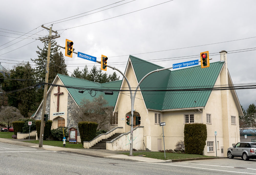
This is Trinity Memorial United Church, one of downtown Abbotsford's historically significant buildings. The church itself was built in 1947, but the spreading of the gospel in Abbotsford dates to 1878, when Reverend Dr. Dunn rode out here on horseback to tend to the souls of the region's few inhabitants.
Dunn was a Presbyterian, and the United Church is the result of a union of the Methodist, Prebyterian and Unitarian churches in 1925, creating the United Church. It was a move Abbotsford's faithful voted overwhelmingly in favour of.
When the church was built it was called the Memorial church to honour those from Abbotsford who fell in both world wars.
11. Old Post Office
This was once the post office. It is designed in a modernist style that was extremely popular in post-World War II public architecture, with a heavy emphasis with function over form, meaning there are few decorative elements adorning the exterior. The post office was built with bricks from the nearby Clayburn Brickworks and served a variety of functions asides from managing the mail, including RCMP detachment headquarters, offices for various federal agencies, and home for the building's caretakers.
It served this purpose for half a century, and now is home to a variety of retail outlets and restaurants. It is a protected heritage site.
12. Essendene's Heritage Buildings
1940
This is a view of the south side of Essendene Avenue, showing several important heritage buildings that survive today.
The brick building on the corner at the left side of the picture was the Alangard Hotel, built to replace the Commercial Hotel on the same spot which burned down in 1922. About 120,000 bricks from the nearby Clayburn Brickworks were used in its construction, and was considered the most modern hotel in the entire Fraser Valley at the time. A nice room cost $3.50 a day, not an insignificant sum at the time. Today it's been rechristened the Fraser Valley Inn, and also houses a pub.
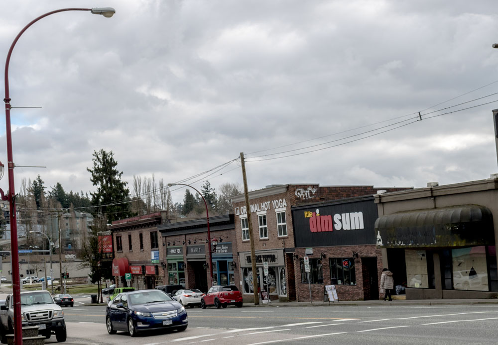
The two-storey building at centre that now houses the Bikram Yoga Studio is another protected heritage building. It was once home to an Overwaitea grocery store and the Teddy Bear Cafe in the late 1940s.
13. A Quiet Day Downtown
1910s
A lone man crosses Essendene Avenue. This is a great shot of Abbotsford's main strip looking back in the direction we started the tour in. Two cars are parked on the street, heralding dramatic change in the years to come, especially when compared to the vast numbers of cars you see when looking down the street today. A flag pole has also been erected in the middle of the street, though it carries no flag.
14. The Street Gets Busier
1947
This photograph, taken from about the same angle and about 30 years after the one from the previous stop, shows the striking changes that have occurred in Abbotsford over that time. The street is filled with parked cars, and many of the buildings that survive to this day are present. It's still possible to jaywalk safely, as we can see from the man in the image. Today you'd be well advised to use the crosswalks!
15. A Bright Future
1910s
A railway trestle once ran along what is now South Fraser Way, and this picture was taken by a photographer standing on it. This view shows just how far Abbotsford has come since its pioneer days. Today it has amalgamated with the districts of Matsqui and Sumas, and is now the largest municipality in British Columbia by area, and is home to over 140,000 people. That's a far cry from the 531 people who called the area home in 1931.