This land has been the traditional territory of the Syilx People of the Okanagan Nation for thousands of years. The first European settlement in the area was the boom and bust mining town of Fairview, located just five kilometers from the current townsite of Oliver. Fairview was immensely successful in the 1890s but, like so many mining towns in BC, had faded to a ghost town by the 1920s. Around that same time, in 1921, one of the South Okanagan's youngest towns, Oliver, was founded through the BC government's South Okanagan Land Project, which worked to open up farm land for returning veterans from the First World War. Premier John Oliver's government purchased 22,000 acres in the region and constructed an extensive irrigation system which transformed 8,000 acres of desert into farmable land. Farming soon took off in the new town, though it was not until the 1980s that vineyards began to be planted on lands which were once orchards. Today, Oliver boasts eleven vineyards and wineries and is the "wine capital of Canada".

This project was made possible through a partnership with Visit South Okanagan, with support from the Oliver & District Heritage Society and Oliver Tourism.
We respectfully acknowledge that Oliver is within the ancestral, traditional, and unceded territory of the Syilx People of the Okanagan Nation.


Explore
Oliver
Stories
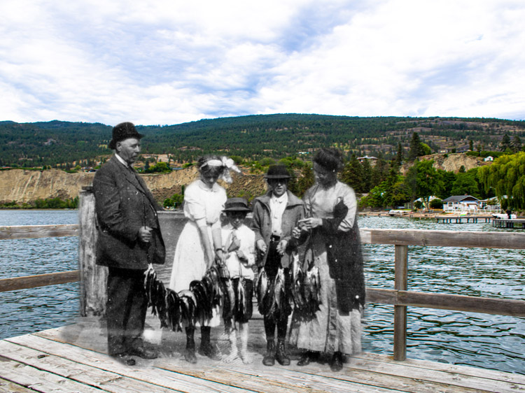
sukʷnaʔqinx - The Okanagan People
Oliver & District Heritage Society OLP.986.14.8
Story Location
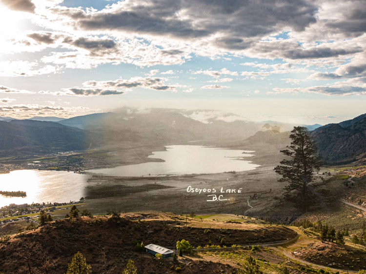
Since time immemorial, the lands of the Okanagan have been the traditional territory of the syilx Nation. The land across the Okanagan River from Oliver are the reserve lands of the Osoyoos Indian Band (OIB) and are a part of the Okanagan syilx Nation, which altogether contains eight communities in Canada and the United States. Today, the OIB's reserve lands measure 32,200 acres and stretches along the eastern side of the Okanagan River across from Oliver, from Gallagher Lake in the north to Osoyoos in the south. These reserve lands originally measured 40,000 acres and included everything east of the Okanagan River, but the crown and government later granted or sold several thousand acres of reserve lands to settlers instead.
* * *
The sukʷnaʔqinx Okanagan People tie their history and identity to the land and the animals that also inhabit it. The Okanagan Indian Band website writes about their origins, "Before humans were created, animal people lived on the land and gave up themselves along with their ways, beliefs, practices, and experiences for the people-to-be."1 These beliefs are passed down today through captíkʷł, or oral narrative.
The captíkʷł carries not only the people's history, but also syilx Okanagan natural law. These laws are based around the beliefs of the stages the Okanagan people have passed through. They are as follows from their website;
"1. st̓əlsqílxʷ (torn from the earth) - life form of first people without natural instincts to survive.
2. xatmaʔ sqílxʷ (in front of us sqílxʷ ) - first thinking people who learned the natural law to survive.
3. sqílxʷ (dreaming ones, bound together, of the land) - original people who learned to live together on the land in peace.
4. ʔawtmaʔsqílxʷ (to struggle and/or come after sqílxʷ) - today’s sqílxʷ after the arrival of new comers."2
This Fur Trade brought settlers to the region, and it wasn't long before they began developing the region around their own settlement patterns. Settler communities often established themselves in sukʷnaʔqin seasonal settlement areas, disrupting the traditional use of these lands. The sukʷnaʔqinx Okanagan people were not given much consideration during the settlement period and were often pushed aside to make room for settler communities.
British Columbia had very few historic land treaties signed between the Canadian government and the Indigenous peoples. Out of the few historic and modern treaties that exist, none cover the Okanagan. These treaties, while deeply flawed and often ignored by the Canadian government, have formed the basis of land rights and titles for Indigenous communities across the country. There are no treaties between the Canadian government and the sukʷnaʔqinx, which has caused ongoing social and economic issues for the suḳʷnaʔqinx Okanagan People.
Historically, the sukʷnaʔqinx Okanagan First Nations travelled in the spring, summer, and fall visiting fishing, gathering, and hunting locations. During the winter, people returned to permanent winter villages where they resided in underground structures known as q̓ʷc̓iʔ. Today in certain areas of the Okanagan, pictographs drawn by the sukʷnaʔqinx are still visible on the rocks.
The language of the Okanagan syilx Nation is nqilxʷcn/nsyilxcən which is a part of the larger Salishan language. nqilxʷcn is one of 23 Salishan languages which are still spoken today across Southern British Columbia, Washington State, Idaho, Montana, and Oregon. Many of the traditional Okanagan place names have been anglicized and used for communities across the Okanagan. The word "Okanagan'' is an anglicized version of the nqilxʷcn word sukʷnaʔqin which translates to "transport toward the head or top end of" and refers to the sqilxʷ that would travel throughout the whole territory to deliver messages.3 Other familiar names derived from nqilxʷcn are kiʔlaw̓naʔ (Kelowna), sən̓pin̓tktən (Penticton), and súyus (Osoyoos).
Today, the Osoyoos Indian Band is thriving and has established a strong economy through viticulture, tourism, and construction. In the last 5 years, they have generated around $120 million through business ventures and partnerships.3 According to Chief Clarence Louie, the Okanagan People have always been skilled at business, “Archeological evidence proves that we traded with tribes from thousands of miles away. Today we’re probably the only band in Canada that has the number of businesses and joint ventures that we have on a per capita basis.”5
The history of Indigenous peoples in Canada is best told by the Nations themselves. To learn more about the Osoyoos Indian Band and the syilx Nation, visit the Nk'Mip Desert Cultural Centre in Osoyoos.
https://okib.ca/about-us/our-history
2. Ibid
3. Ibid
4. "Businesses" Osoyoos Indian Band. 2021. Website
http://oib.ca/businesses/
5. "Our People" Nk'mip Desert Cultural Centre. 2021.
https://nkmipdesert.com/our-people/
Irrigation in Oliver
Oliver & District Heritage Society OLP.982.219
Story Location
The town of Oliver owes its existence to a vast public works project known as the South Okanagan Lands Project that transformed 8000 acres of desert into irrigated farmland. In 1918, BC Premier John Oliver, for whom the town was named, envisioned the agricultural potential in the lands if they could only be irrigated.
* * *
The provincial government purchased 22,000 acres in the South Okanagan for the purposes of this project and the newly irrigated land was offered to veterans returning from fighting abroad in World War I at a low cost. In 1921, the townsite for Oliver was surveyed, and the first buildings erected in the new townsite were constructed from reclaimed lumber salvaged from the vacated buildings at the former boomtown of Fairview.
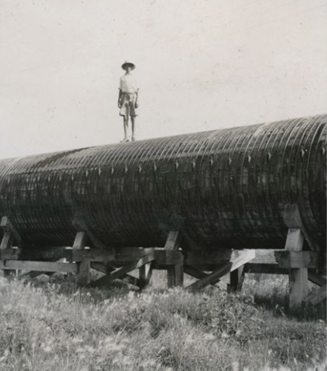
To successfully irrigate the valley, a 40 kilometer concrete irrigation canal was built in 1923. The canal included a wood stave siphon that measured a little over 2 metres in diameter and ran almost 1.2 kms. The siphon transported water from one side of the valley to the other. Installing the "Ditch" as locals call it, transformed a dry desert valley into sprawling acres of orchards, farms, and vineyards. The siphon once ran up what is now School Avenue, and propelled the water upwards. Much of the irrigation system now runs underground, but there are areas where it resurfaces, namely where it crosses the Okanagan River. It can be seen from the Fairview Road bridge.
In 1949, the Okanagan River was dug into a canal between Okanagan Falls and Osoyoos. Dams and drops were added to adjust lake water levels and provide flood control during the spring run off. While this has been beneficial to farms and settlements, the channelization of the river has had a powerful effect on the river ecosystem.
In 2017, the Okanagan River Restoration Initiative reported that only 16% (4.9 km) of the river remained in a natural (2.8 km) or semi-natural state (2.1 km) and, that 84% (30.4 km) of the river had been channelized, straightened, narrowed and diked.1 The ORRI has been working for several years on restoring portions of the river to a more natural state and reclaiming habitat by replanting riparian zones, relocating dikes, lengthening the channel, re-establishing habitat features such as fish spawning beds, gravel beds, and pools.
They are also expanding the bounds of the river by reconnecting the river to contiguous floodplains and creating side channels. Their work has led to increased use of the river by species such as sockeye salmon and rainbow trout, as well as some bird and toad species. The ORRI was founded in 2000 and is a partnership between several organizations, including the Okanagan Nation Alliance, Canada Fisheries and Oceans, and the Okanagan Region Wildlife Heritage Fund Society.
Fairview
Oliver & District Heritage Society
Story Location
This barren section of desert hillside was once the location of one of BC's biggest mining boom towns. The first people in this area were the Syilx First Nation, followed by fur traders, then ranchers, then by prospectors who discovered gold in the hills. The first prospectors to discover gold in the hills behind modern-day Oliver were a man known as "One-Armed Reed” and his partner Ryan. They started by panning for gold in the creeks, but they didn't find enough gold to justify staying and soon moved on. Others after them found that the majority of the gold was in the ground rather than the creeks and decided mining was the proper course of action rather than panning.
* * *
The first mining claim, the Stemwinder, was founded In 1887. The first mine, called the Rattler, opened the next year. Only four years later, the area was home to a total of 10 mines, including the large Morning Star Mine. This mine opened in 1889, attracting notice from gold seekers who began flooding into the area. A stamp mill was soon established in Fairview where rocks were processed to extract gold and quartz.
The Stratheyre Mining Company, the owners of the Morning Star Mine, built a house across from the mine in a location that gave it a vantage point overlooking the valley. The "fair" views from this spot gave the growing community its name. Fairview became home to miners, ranchers, and businesses. The growth led to a need for some basic community amenities. The first hotel in town was the Golden Gate Hotel, built in 1890. While the Golden Gate was the first, the Hotel Fairview was the best. It was built In 1897 as a large three-storey hotel with a pointed wooden tower on the roof. The hotel was known as the fanciest hotel in the Okanagan and was known for its good food, which was served on fine china with silver cutlery.1
As the town grew it established horse stables, grocery stores, a drug store, a post office, a blacksmith, a butcher shop, a school, churches, a government building, and a jail. At the height of its growth, there were around 1000 people living in Fairview and it was one of BC's largest towns at the end of the 1800s.
When J. M. Robinson, founder of Naramata, Peachland, and Summerland passed through Fairview, he had this to say of the town, "The town of Fairview is not inappropriately named, for it looks out onto a prospect as desolate as one could well find outside of the Sahara Desert. Nevertheless, the view is all fenced in by ranchers, whose cattle manages to pick up a living by working faithfully on day and night shifts. If the valley were only irrigated it could look like a paradise."2
As impressed as Robinson may have been by the views, he was less enthused about the valley heat, "When the midsummer sun catches the traveller in that gulch and pours down his angry beams upon him in one flood of etheric fire, he presently begins to find himself melting away on his horse like so much drawn butter."3
Despite Fairview's promising beginnings, the Hotel Fairview burnt to the ground in 1902, killing three people and injuring several others. This disaster coincided with a sharp downturn in the mines' fortunes as the miners turned up less and less gold. In 1904, the Stemwinder, the town's most important mine, closed its doors, with others following suit. The town began to decline and people moved away. By 1907, the Church of England's registry showed only 145 people remaining in Fairview.4
The Morning Star Mine reopened in 1933 and was minimally profitable for a short period. However Fairview failed to recover as the majority of people in the area had now settled in nearby Oliver. The mine soon declined and finally shut permanently in 1961.
2. John Moore Robinson "West to Grand Forks and Beyond" in The Journal of the Okanagan Trust Society 3, No. 4 (Spring 2018), 12.
3. Ibid.
4. "History" The Town of Oliver, 2021. https://oliver.ca/history/
Then and Now Photos
The Land Office
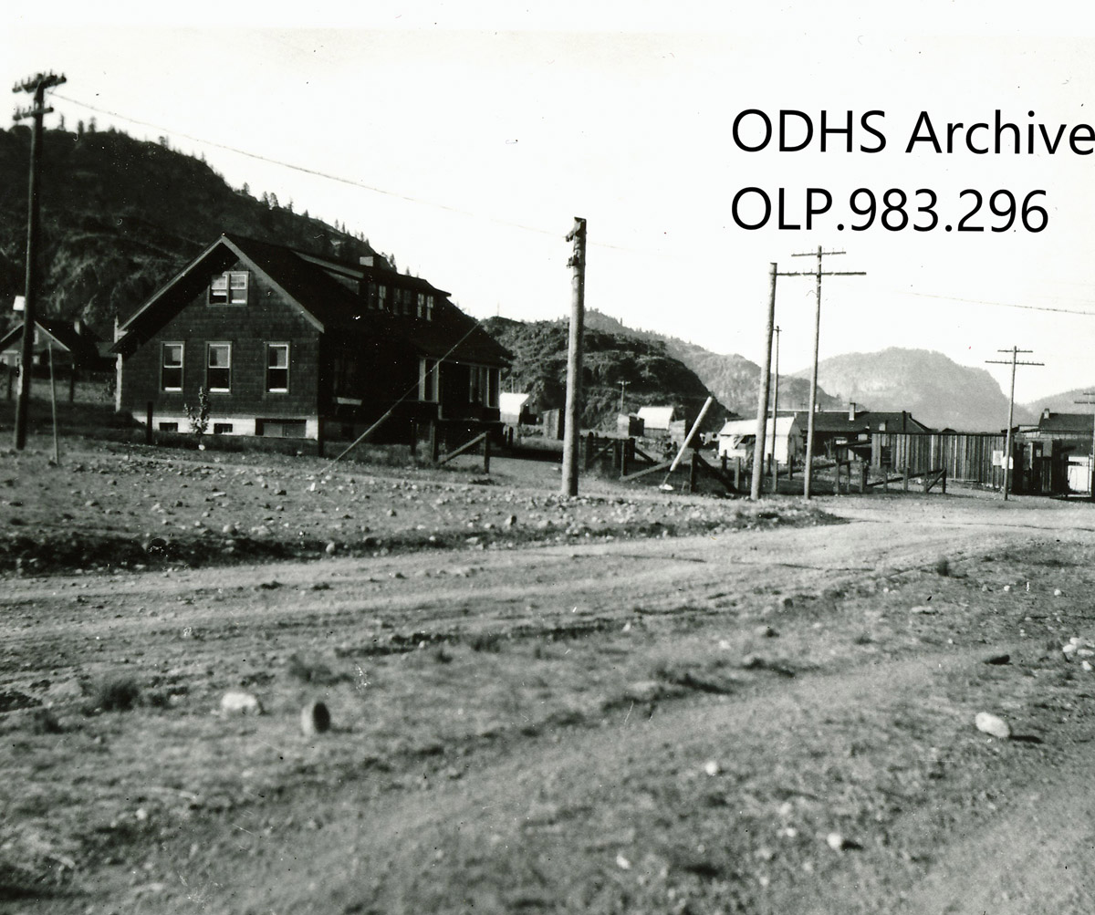
Oliver & District Heritage Society OLP.983.296
1920s
The building in this photograph from the 1920s is now the Town of Oliver offices, but was originally built to house the South Okanagan Lands Project offices. The dirt road in front of the building is Main Street in its early years.
The Palace Pool Hall
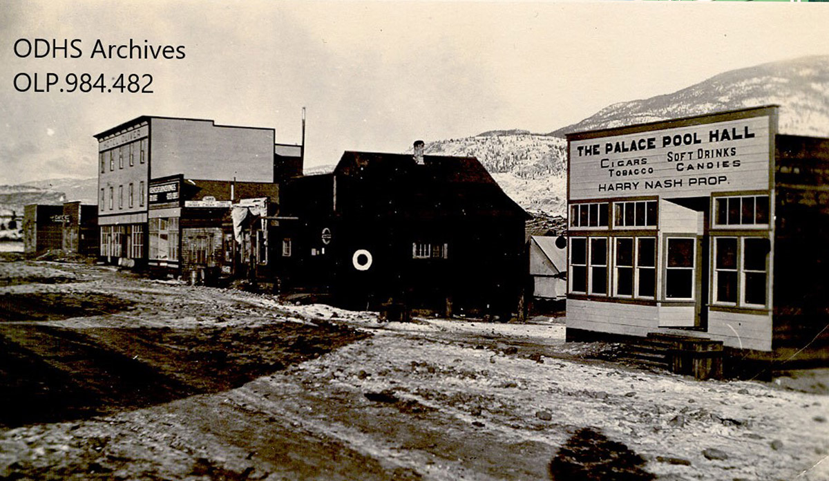
Oliver & District Heritage Society OLP.994.093
1920s
Harry Nash's Palace Pool Hall was located on Main Street in the 1920s, as seen in this photo. Farther down the road is the Hotel Oliver. This photo is clearly taken in winter, as you can see snow on the hills behind Main Street.
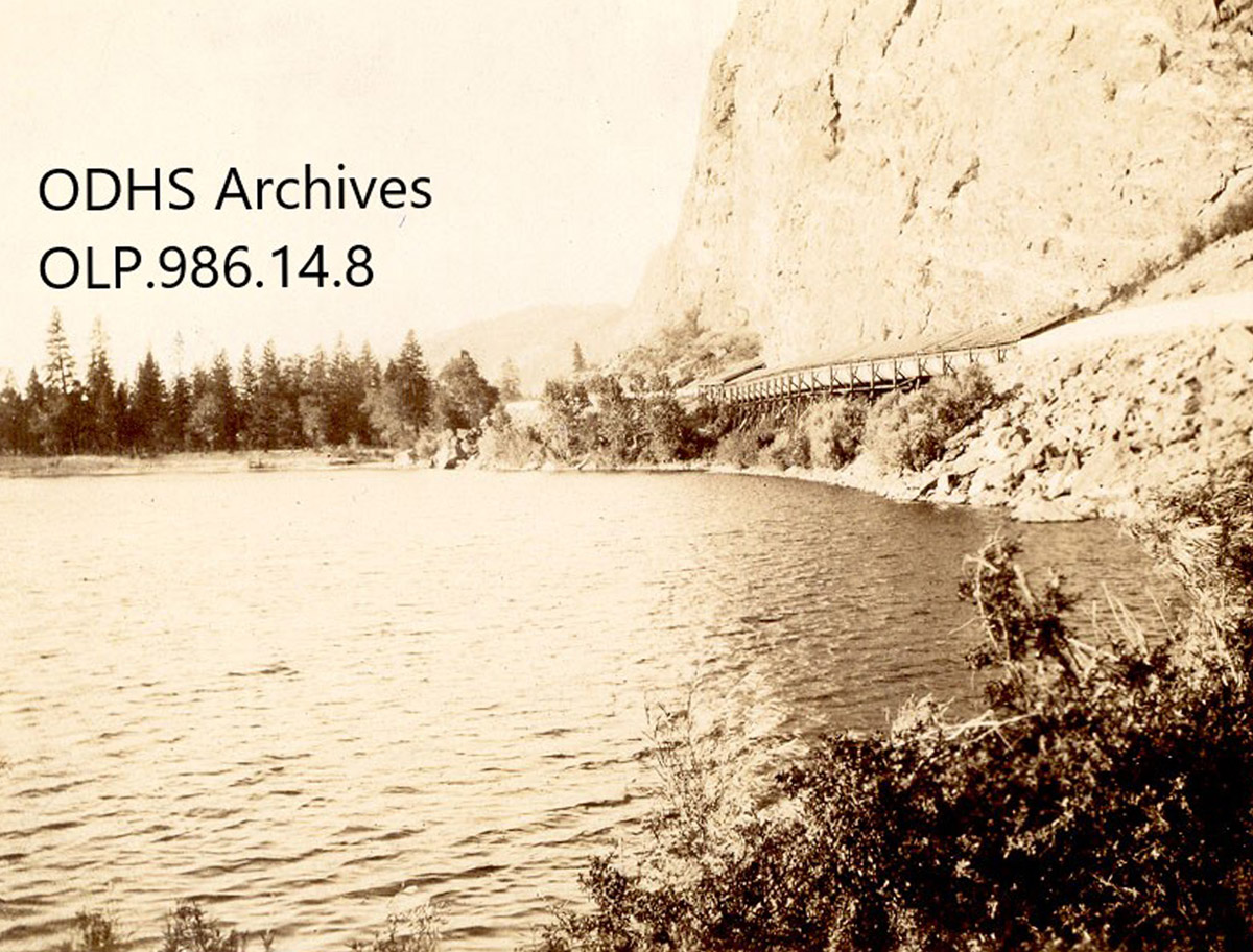
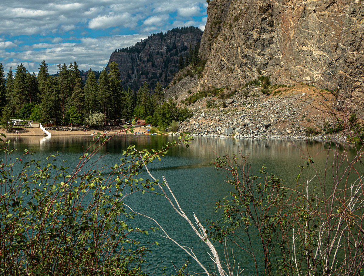
Gallager Lake
Oliver & District Heritage Society OLP.986.14.8
1930
This photograph of Gallager Lake, which is located north of Oliver, shows the irrigation flume that was built along one side of the lake. Today, the flume still exists but runs under the ground.
A Wheelbarrow Race on Main Street
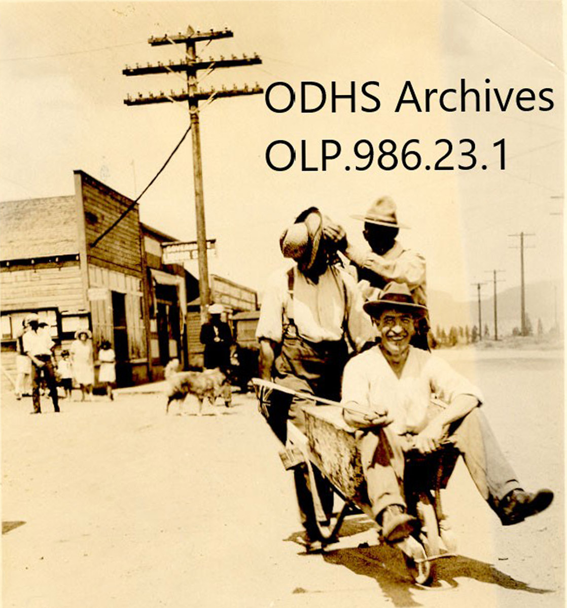
Oliver & District Heritage Society OLP.986.23.1
1935
The wheelbarrow race portrayed in this photo was the result of a bet made during election seasons. The winner of the bet, George Mabee, received a wheelbarrow ride all the way from one end of Main Street to the other, pushed by the loser of the bet, Harry Parsons. Val Haynes stands next to the racers in this photo, moping Parsons's brow.
The Oliver Theatre
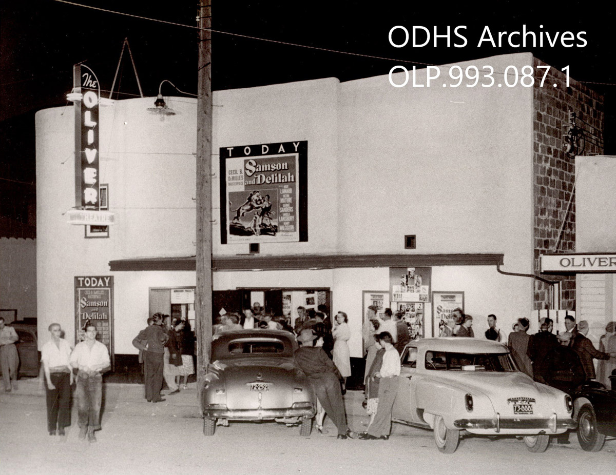
Oliver & District Heritage Society OLP.989.097.3
1947
The Oliver Theatre on Main Street opened in 1947, just shortly before this photograph was taken of it. The film playing is Samson and Delilah, a drama depicting a biblical story. Today, the Oliver Theatre still stands in its original form.
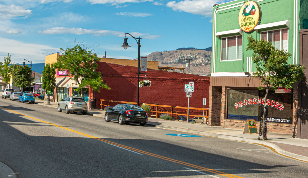
Oliver Hardware
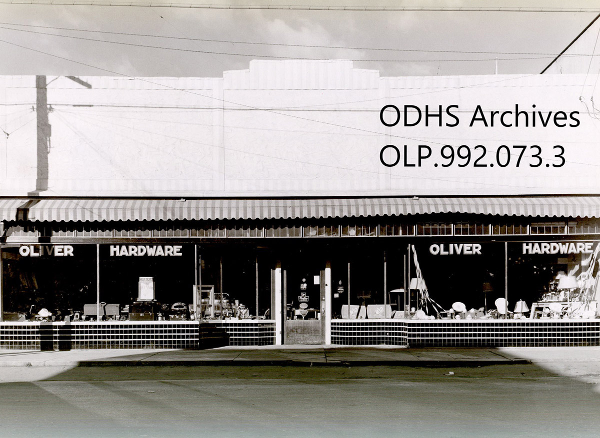

Oliver & District Heritage Society OLP.984.482
ca. 1950s
This building, located on Main Street, was once the Oliver Hardware Store. This photograph was likely taken in the 1950s, as the main road is now paved.
The Fire Hall
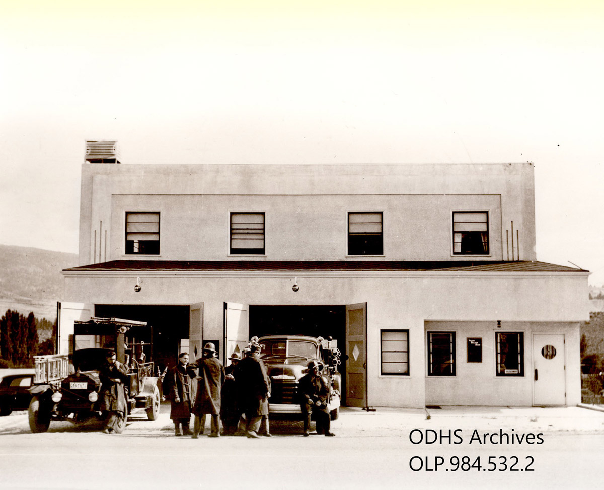
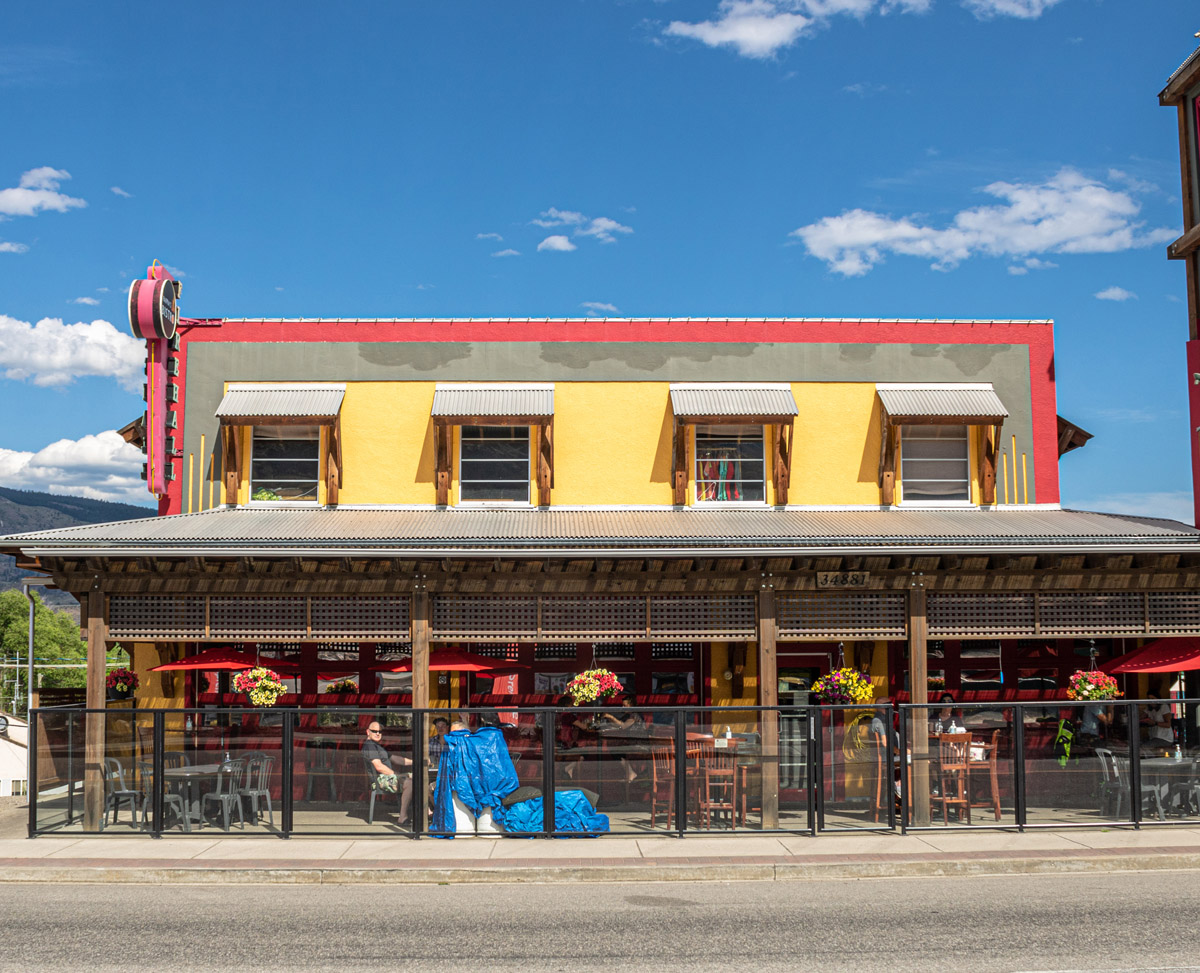
Oliver & District Heritage Society OLP.984.532.2
1950s
This building was built in 1948 and served as Oliver's Fire Hall until the construction of a new hall in 2000. Currently, the heritage building is home to Pappa's Firehall Bistro.
Oliver's High School

Oliver & District Heritage Society OLP.988.73.1
1950s
The high school in this photo was built in 1948 and remained in operation until devastated by a fire in 2011. When the school was originally built, tunnels were dug underneath it to provide emergency shelter in case of bomb threats, but these tunnels have since been removed.
Oliver's Elementary Schools
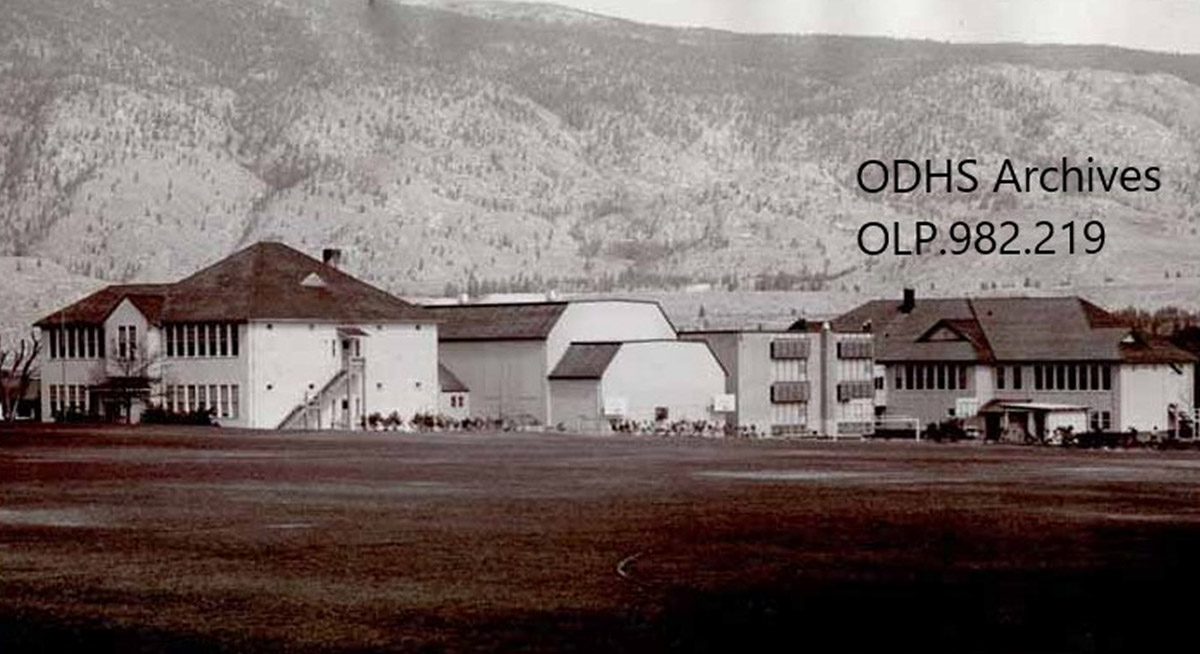
Oliver & District Heritage Society OLP.994.096.9
1982
This photograph from 1982 shows three of Oliver's Elementary Schools. On the far left is the school built in 1941, while in the center is the one constructed in 1964 and on the right is the building which first opened as an elementary school in Oliver in 1929. This last school was demolished in 1990.