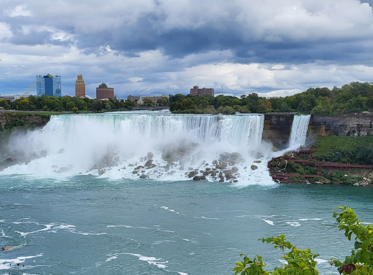
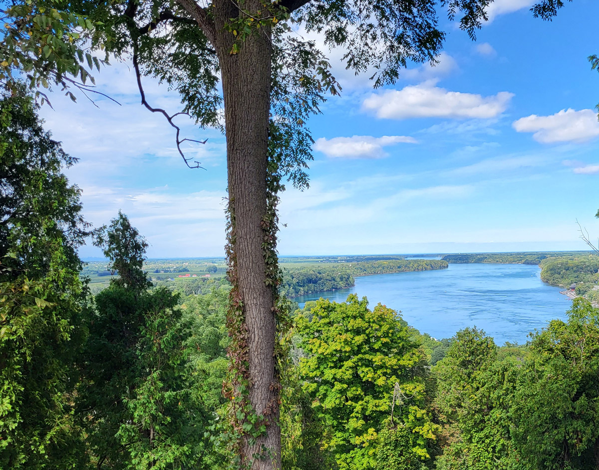
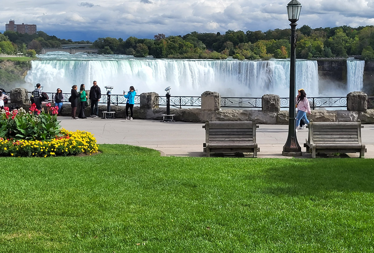
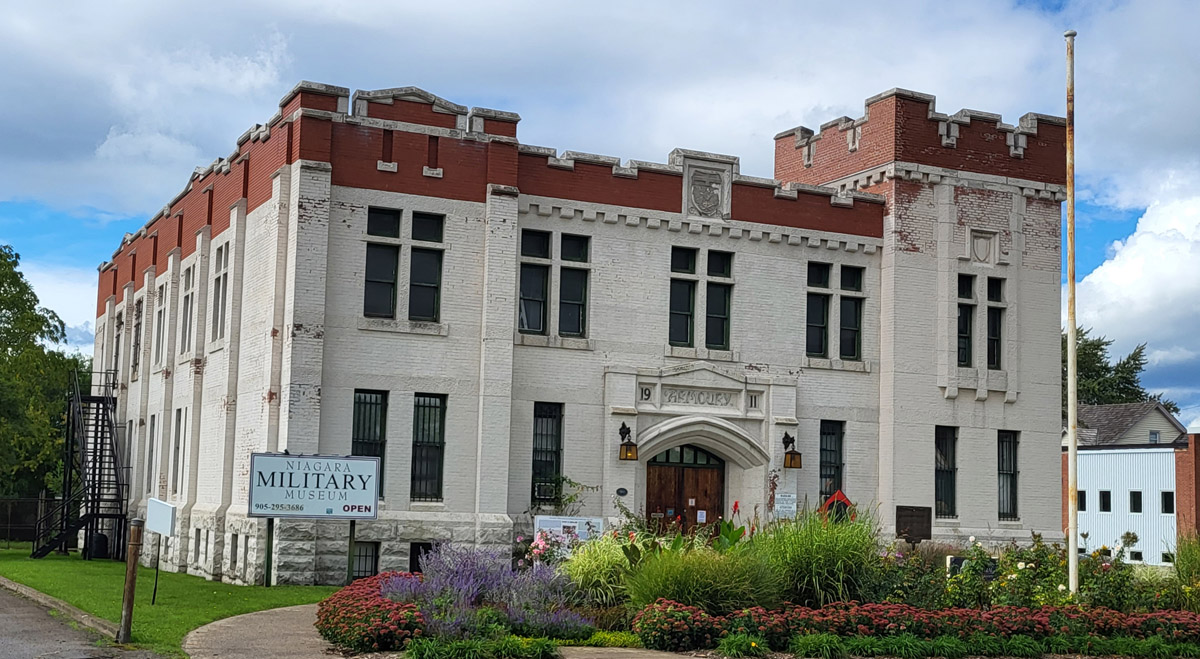
Niagara's legendary falls are one of the most breathtaking natural wonders in North America. They are located on the Niagara River, which draws from Lake Erie and empties into Lake Ontario, and serves as the international border between Canada and the United States. The place has been inhabited by and travelled through by many Indigenous peoples for many thousands of years. The Indigenous guides of the French explorer Samuel de Champlain led him to this place to see the spectacular waterfalls in 1604. Following the American Revolutionary War, the Niagara River came to represent the border between British and American-held territory, and settlements eventually grew up on both sides of the river. During the War of 1812 the Americans launched invasions of Canada along this river. They were defeated however, first at the Battle of Queenston Heights in 1812 (the heights are located just north of the city of Niagara Falls) and at the Battle of Lundy's Lane (located just west of downtown Niagara). Immediately thereafter Niagara Falls became Canada's first major tourist destination, with people coming from far and wide on both sides of the border to see the falls. Apparently the first couple to have recorded as honeymooning there was in 1801 (the American Vice President's Daughter and her husband), and things took off from there. It's still nicknamed the Honeymoon Capital of the World with good reason. During the First World War the Canadian government rounded up many so-called "enemy aliens" and interned them at the Niagara Armoury. That history will shortly be the subject of a comprehensive virtual tour of the site we will be launching in spring 2023.
This project has been made possible by a grant from the Endowment Council of the Canadian First World War Internment Recognition Fund.
We respectfully acknowledge that the land on which Niagara Falls is located is the traditional territory of the Haudenosaunee and Anishinaabe peoples, many of whom continue to live and work here today. This territory is covered by the Upper Canada Treaties and is within the land protected by the Dish With One Spoon Wampum agreement. Today this gathering place is home to many First Nations, Métis, and Inuit peoples.
Donate Now
If you enjoyed this free content, we ask you to consider making a donation to the Canada-Ukraine Foundation, which is providing urgently needed humanitarian aid to Ukraine.
The Ukrainian people are heroically defending their homeland against a genocidal war of Russian aggression. The humanitarian situation is critical and the needs immense. 100% of all donations made through this link go directly to supporting the people of Ukraine. Recently funded initiatives by the Canada-Ukraine Foundation include demining and removal of unexploded ordnance, and the evacuation of thousands of deaf people from the warzone.


Tours
Explore
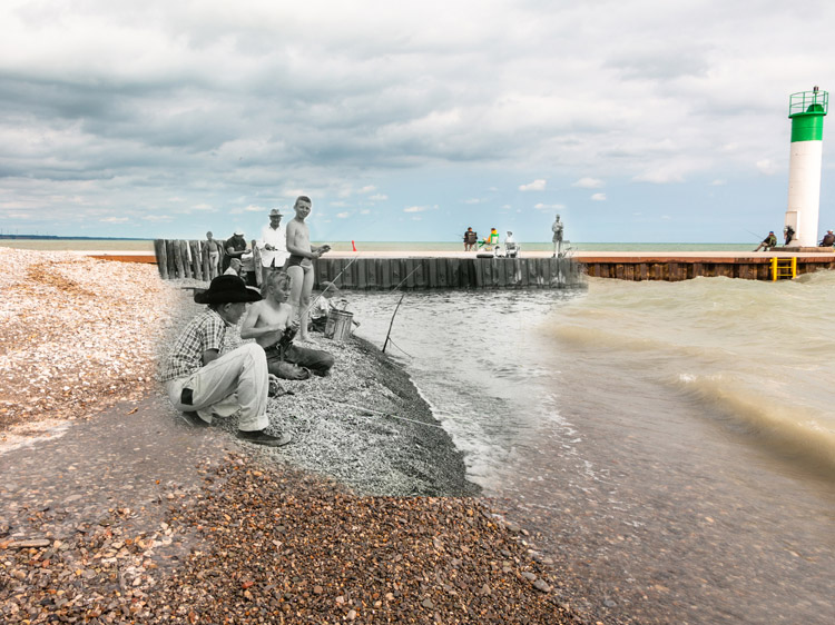
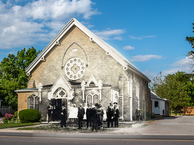
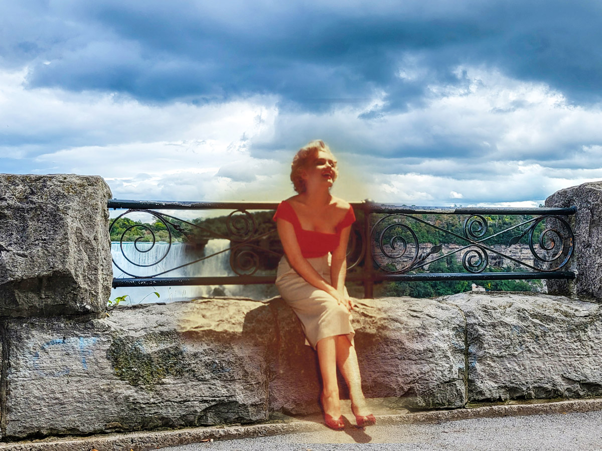
Niagara Falls
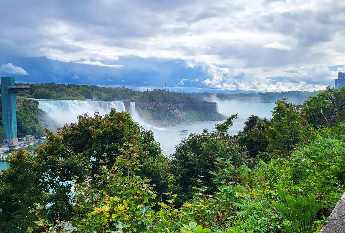
Then and Now Photos
Painting of both Falls
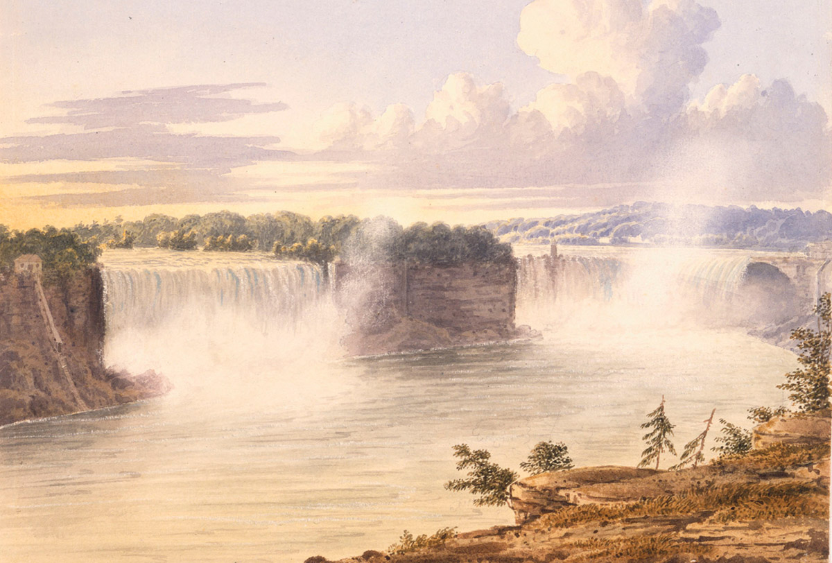
Library and Archives Canada 2833477
ca. 1846
A painting by John Herbert Caddy of the falls.
Viewing Horseshoe Falls
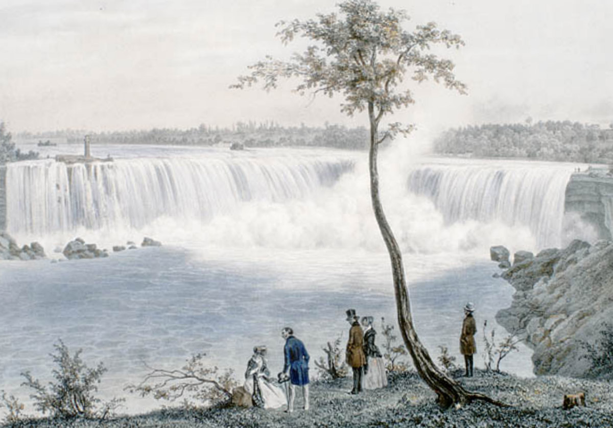
Library and Archives Canada 2897254
1848
Well-dressed couples enjoying the view of the Falls in the middle of the 19th Century.
Moody Horseshoe Falls
Library and Archives Canada 3318101
1877
The Horseshoe Falls as seen in the 1870s. For the time it is a fairly impressive exposure showing clouds and fine differences in lighting across a large landscape, not something you often see until photographs from the 1910s and 1920s.
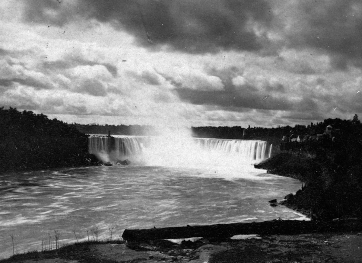
View of the American Side
Library and Archives Canada 3328906
ca. 1870s
A view over the falls towards Niagara Falls, NY, during a dramatic wintertime ice buildup.
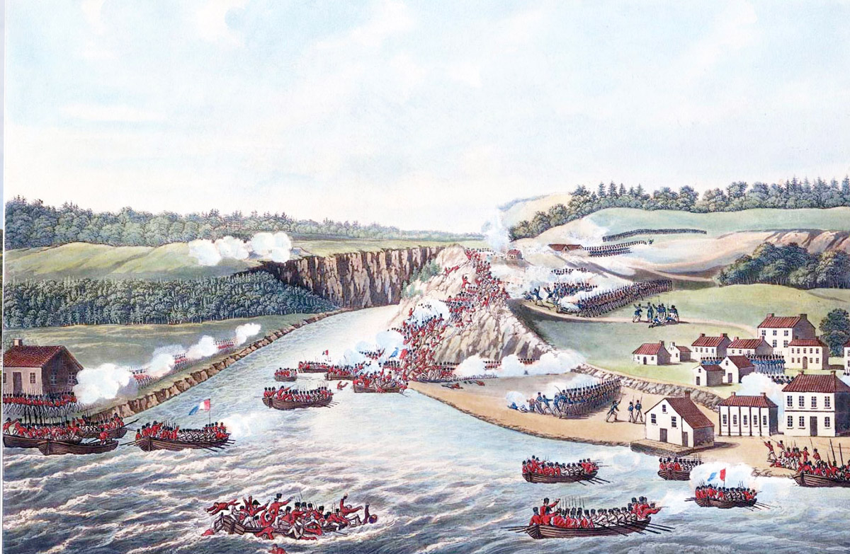
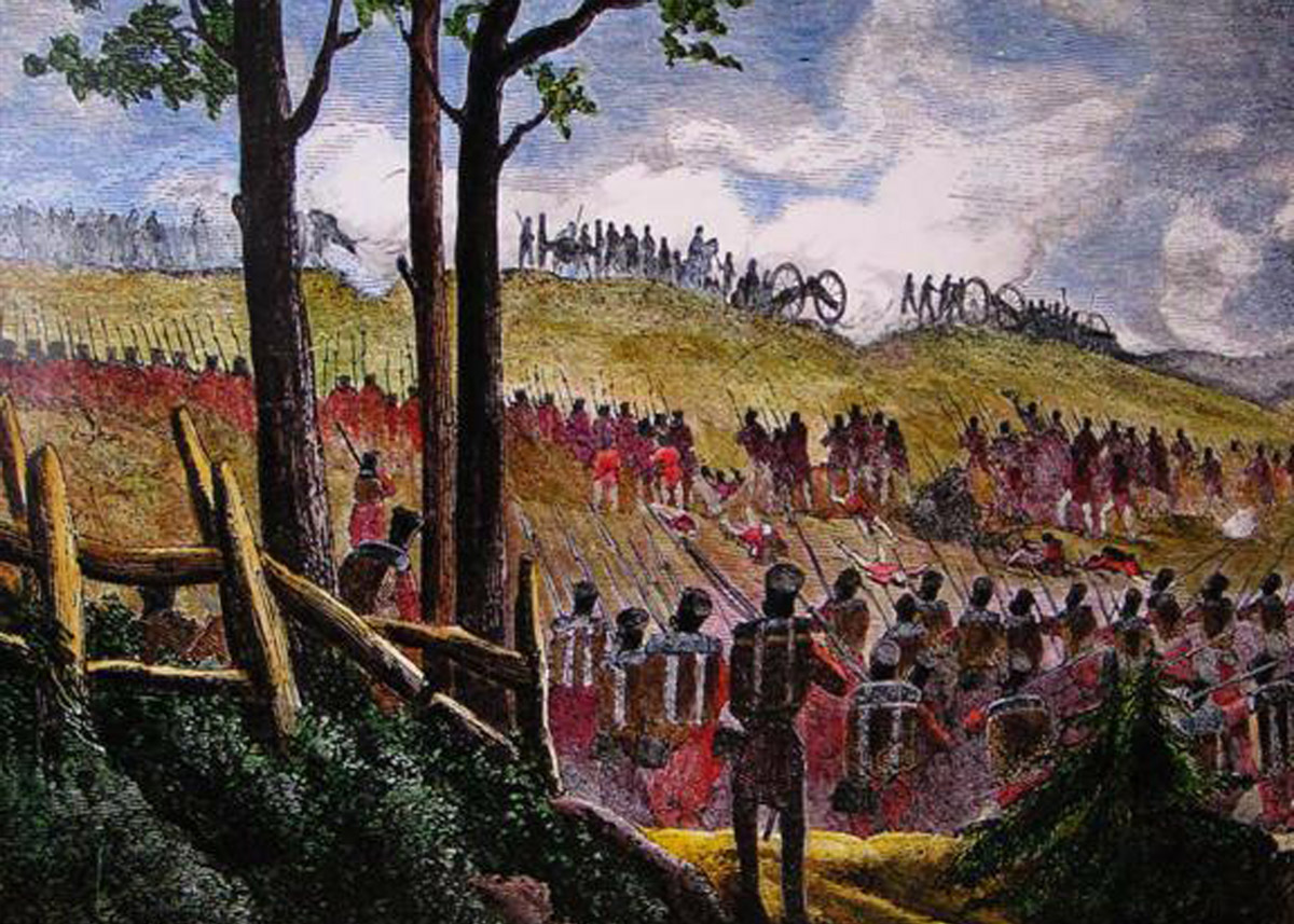
The Battle of Queenston Heights
1812
A dramatic painting showing the Battle of Queenston Heights, one of the most pivotal battles of the War of 1812, which saw a decisive American defeat on the Niagara Frontier, and the death of the British commander Major General Sir Isaac Brock. The modern-day perspective photo was taken with a drone.
In this image you can see American boats (confusingly, the American troops in them are wearing red, the traditional British colours) making the crossing. Some are taking heavy fire and foundering. American troops are pouring up the heights, seeking to capture the Redan, a British artillery position with a commanding view of the river.
The British (once again, confusingly, in blue) are seen defending the heights and the hamlet of Queenston at right. The Americans were able to capture the heights, but many of their poorly trained and led troops refused to cross the river, and the success was not reinforced. General Brock boldly led an assault to retake the heights, marching point blank into American fire, and was killed. His British regulars and Canadian militia, supported by Chief John Norton and 80 Mohawk warriors, were fired by fury over the death of their beloved leader, stormed the heights and threw the Americans back across the river.
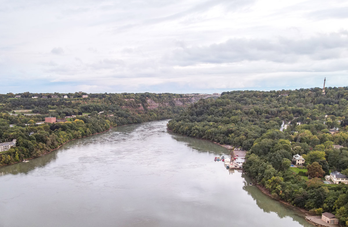
View from the Heights
Library and Archives Canada 2895749
1816
A view of the Niagara River from Queenston Heights. This painting was created just a few short years after the battle, and gives a vivid idea of the decisive the British artillery positions at the Redan (a short distance down the slope from where the painter was sitting) would have played in a battle fought over a crossing here.
The village of Queenston can be seen at bottom right, which was the scene of the heaviest fighting and where Major General Brock fell. The small house butting out into the river at right is roughly where the American troops would have embarked for the river crossing. Clearly, crossing the river in a strong current under accurate fire from artillery at these heights would have been a challenging prospect in the best of times.
The British Assault
1814
The British attack from the north to retake the cemetery on the heights at the Battle of Lundy's Lane.
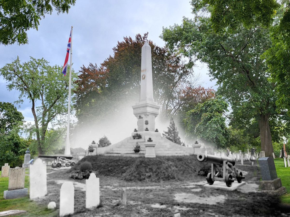
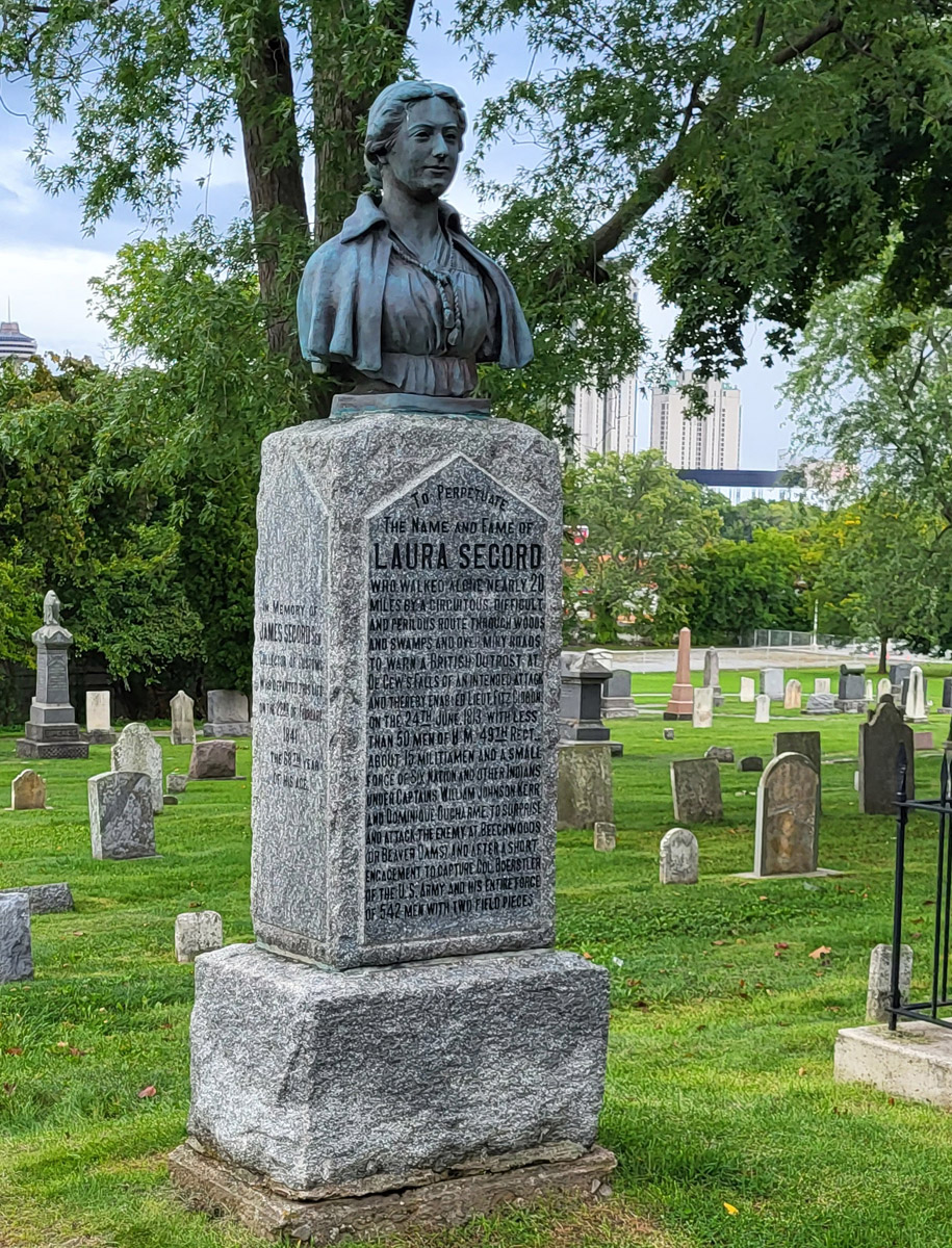
Laura Secord Monument
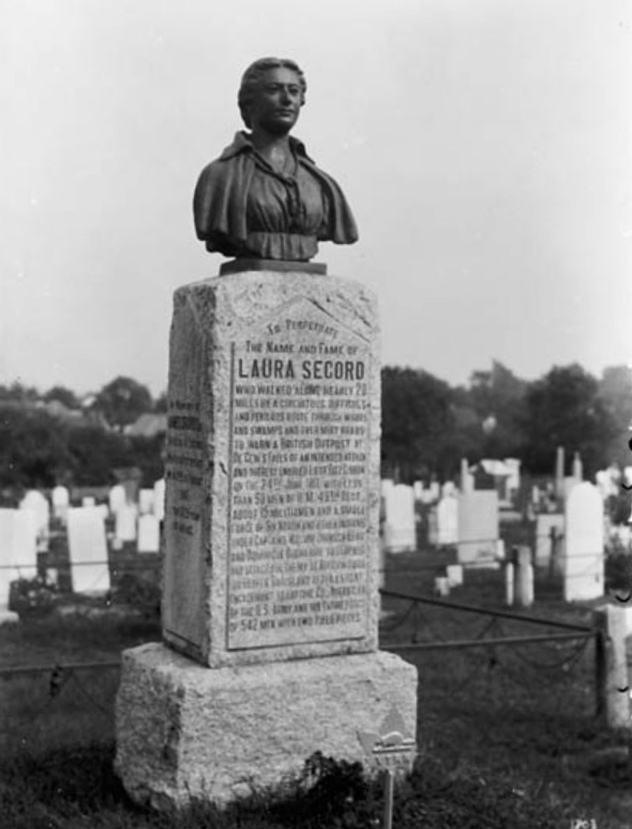
Library and Archives Canada 3318035
ca. 1910s
Laura Secord's Monument at Lundy Lane Cemetery.
She was a hero to Canada during the War of 1812, walking 30 miles out of American-held territory to warn the British of the impending American offensive, leading to an American defeat. She remained largely unrecognized for this feat throughout her long life.
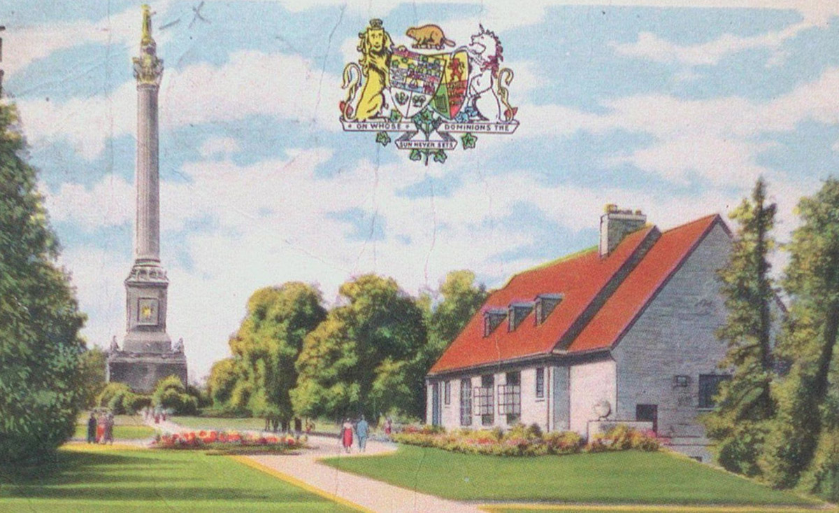
Restaurant and Monument
ca. 1915
A postcard showing the Brock Monument overlooking Queenston Heights. At right is the Queenston Heights Restaurant, which still exists today.
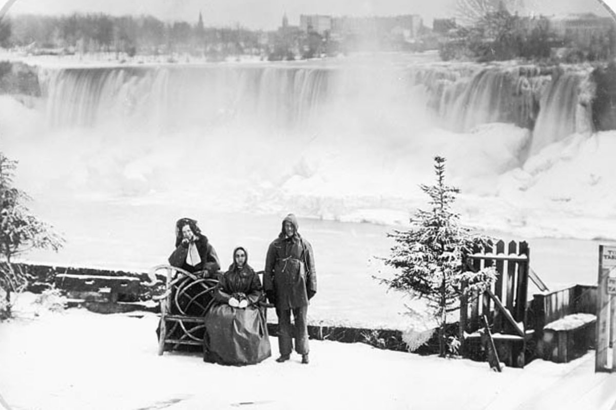
Table Rock Portrait
Library and Archives Canada 3255638
ca. 1850s
Two women and a man pose for a Daguerrotype portrait in front of the frozen falls. It's interesting to note their Victorian era winter attire.
Young Couple
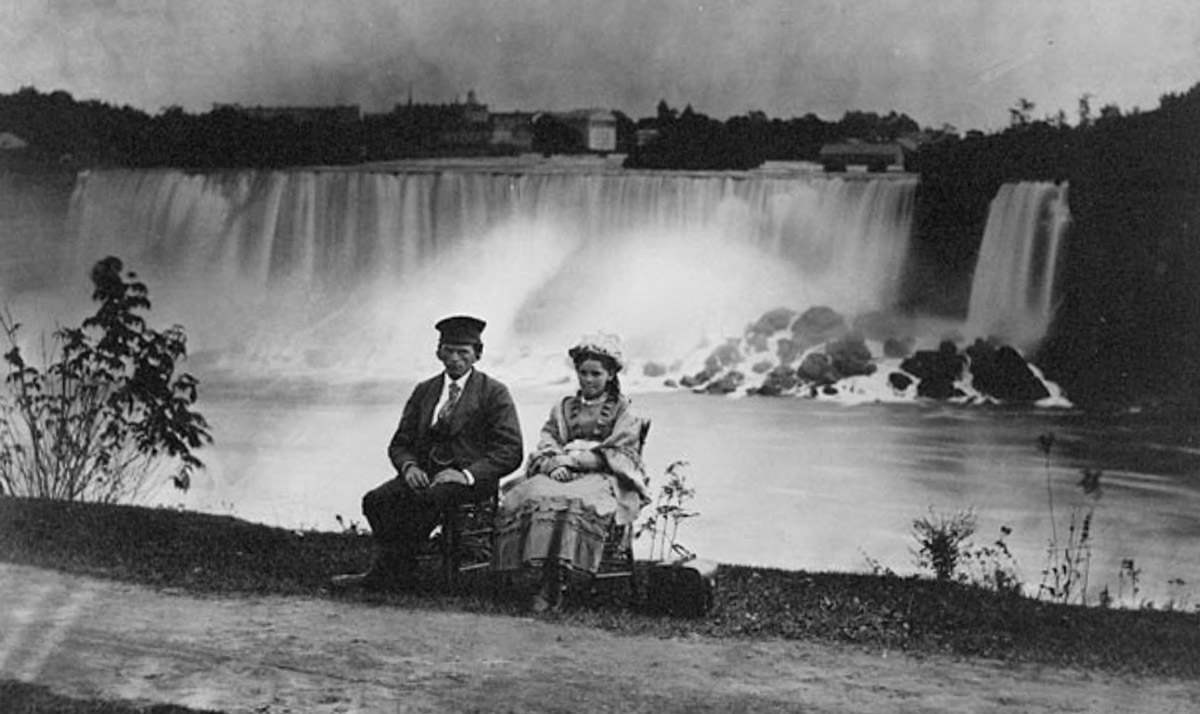
Library and Archives Canada 3192097
ca. 1858
A young man and woman sit for a photo in front of the falls. Their stiff poses and awkward expressions—with the man glowering impatiently at the photographer and the woman evidently pursing her lips—may be the result of the exceedingly long exposures required for photographs taken at this early date in the history of photography.
The Davidsons
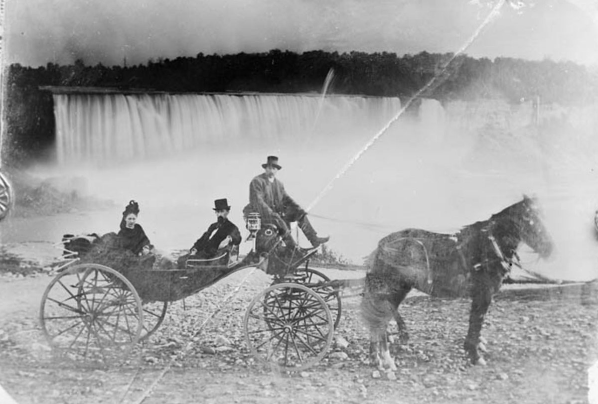
Library and Archives Canada 3466137
1892
A Mr. & Mrs. Davidson pose for a photo in front of their falls in their buggy, along with their driver and his horse.
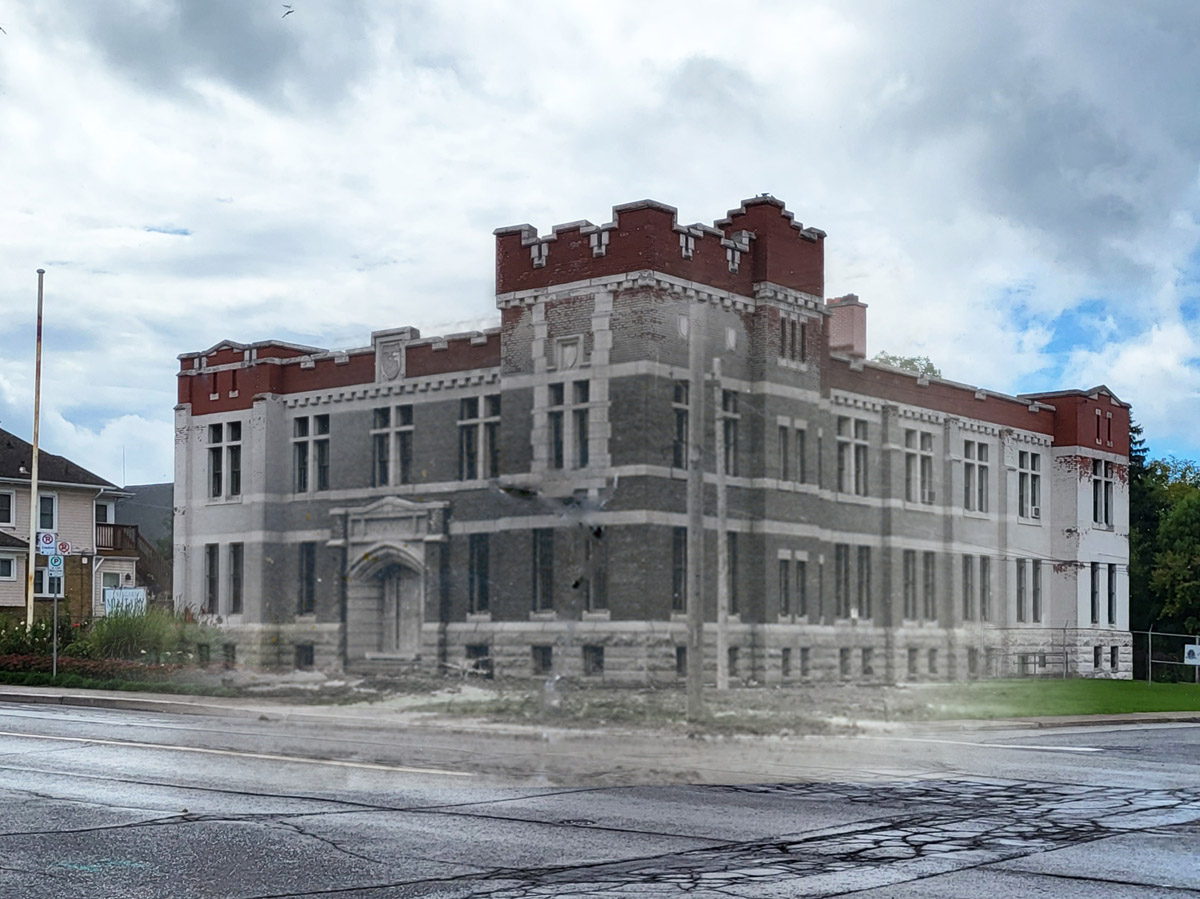
Buggy at the Armoury

1911
A buggy parked in front of the Niagara Falls Armoury shortly after its completion.
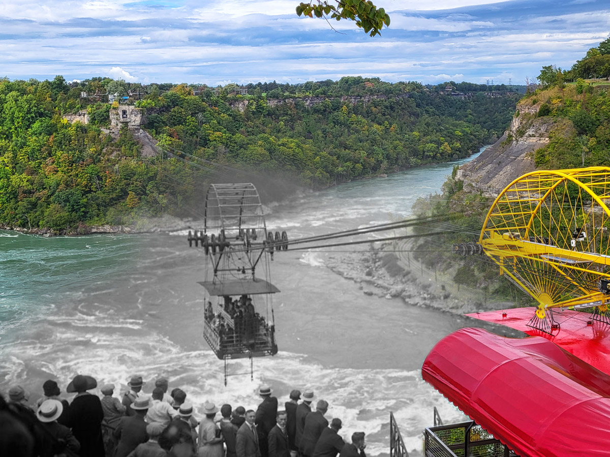
Exit of the Whirlpool
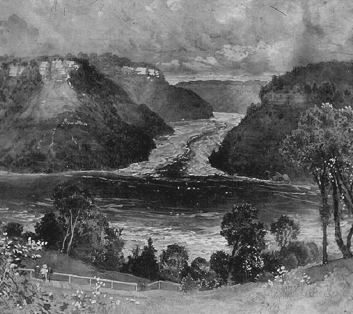
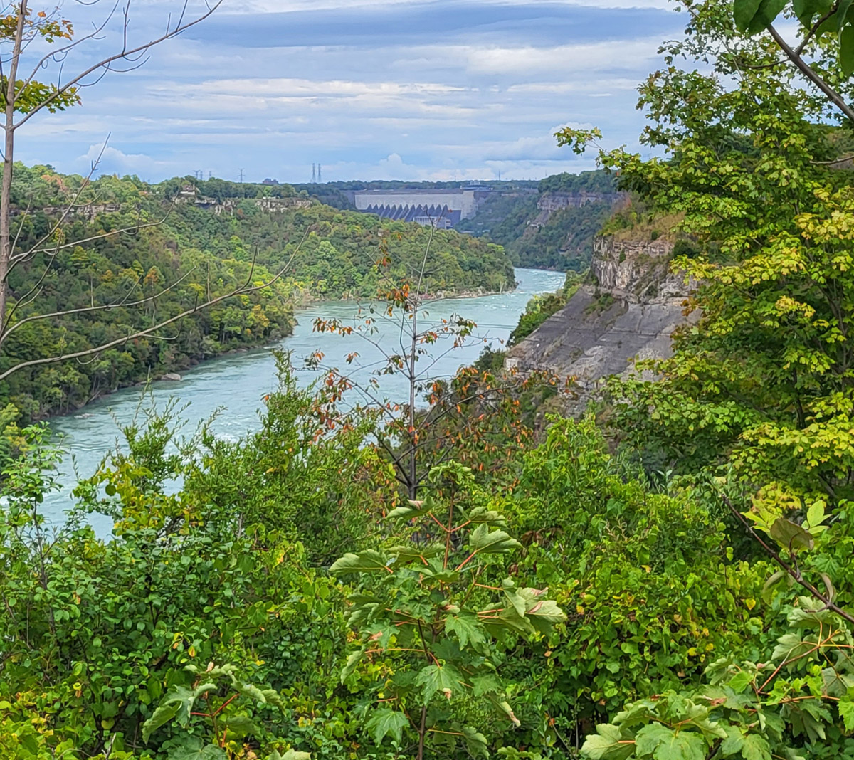
ca. 1890s
A sketch drawing showing the exit to the famous Niagara Whirlpool.
Schoellkopf Power Station
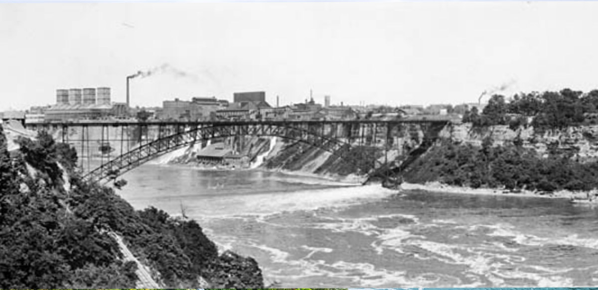
Library and Archives Canada 3261899
1910
In this photo the Schoellkopf Power Station, named for the man who owned the and on which it was built, can be seen behind the Rainbow Bridge on the American side of the falls.
Toronto Power Generating Station
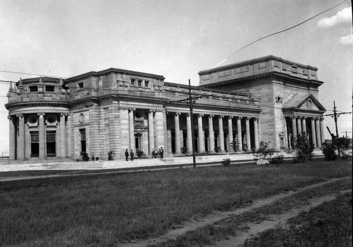
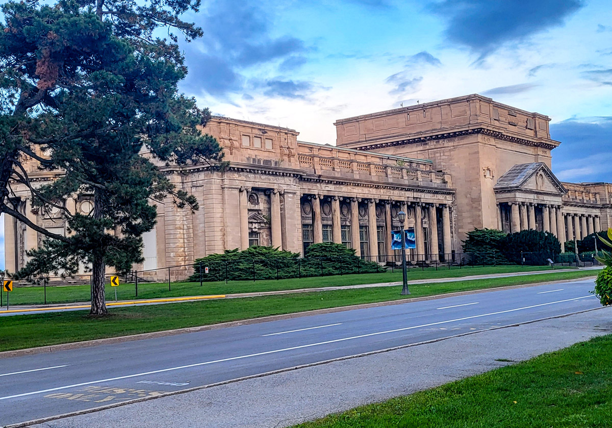
Library and Archives Canada 3318012
1914
This imposing Beaux-arts style building located just above the falls was a hydroelectric power station. This station represented an important development in the development of hydropower on the Niagara River and continued operation until 1974. Today it is a National Historic Site.
Bussing in Winter
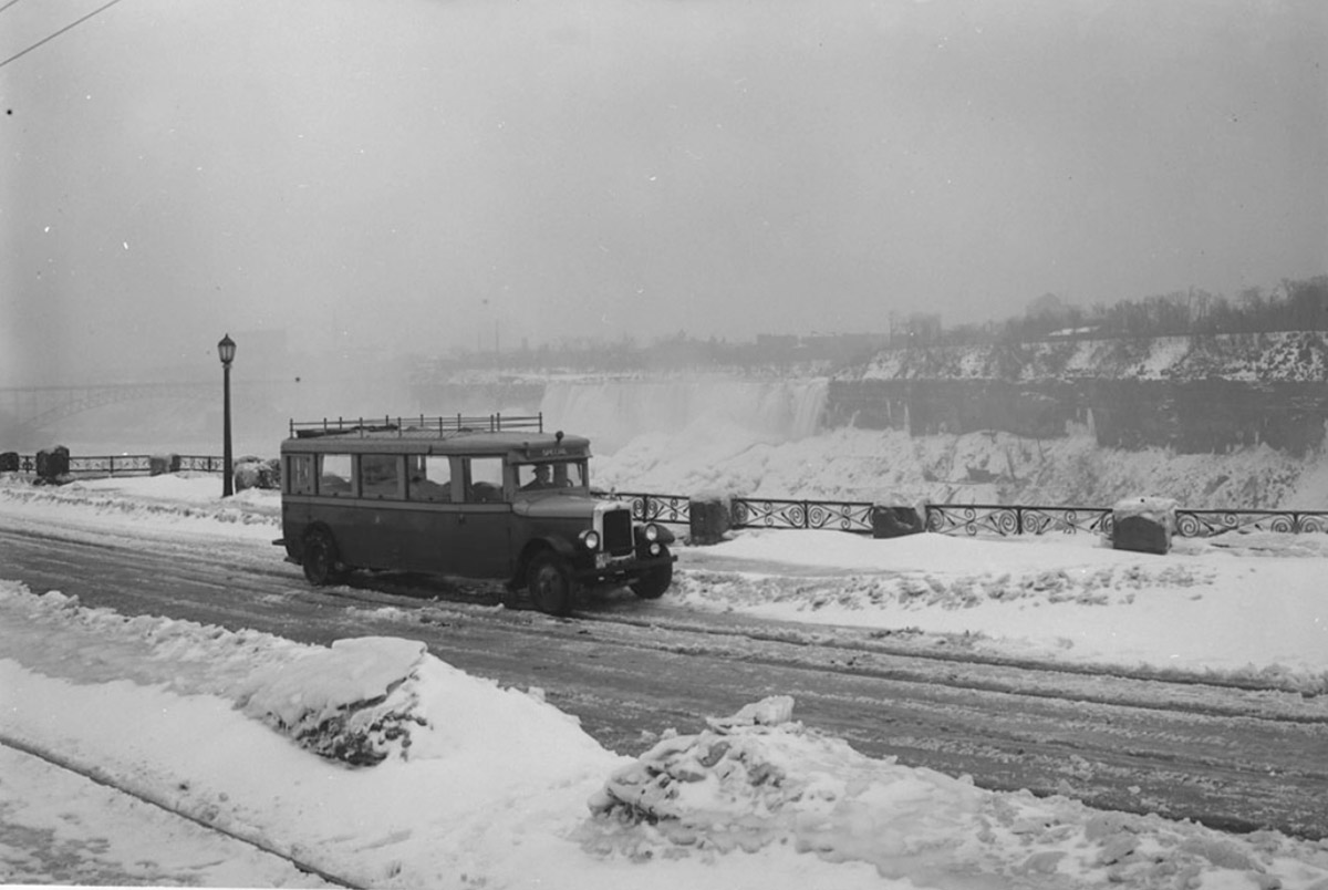
1927
A Toronto Transit Commission bus struggles to negotiate the wintry roads as it shows tourists views of the falls on Valentine's Day, 1927.
The Clifton Hotel
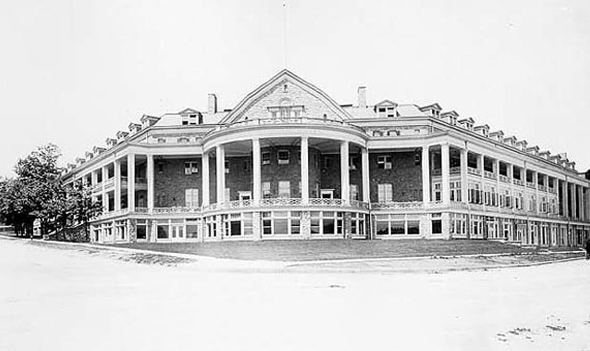
ca. 1920s
Originally built by one Harmanus Crysler in 1831, the Clifton Hotel was one of the most prominent hotels in early Niagara Falls. During the US Civil War, it was the site of diplomatic meetings between North and South. The first hotel was destroyed by fire in 1898. The building you see here replaced the original, and was completed in 1905.
Clifton Hotel Burned Down
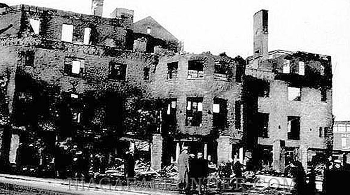
1932
This was the fate of the second Clifton Hotel, one of the most prominent hotels in early Niagara Falls. A fire on New Years Eve, 1932, almost exactly a century after the first Clifton Hotel was built. After the 1932 fire the Clifton was never rebuilt. Instead the property became home to the Oakes Garden Theatre.
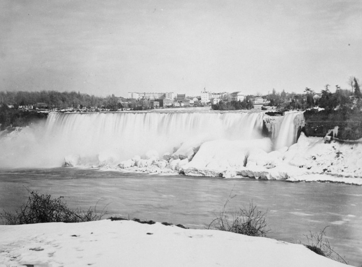
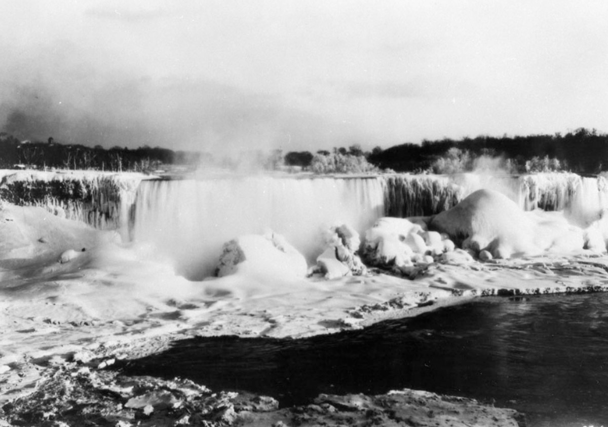
The Ice Falls
Library and Archives Canada 3318088
ca. 1930s
The freezing of the falls causing a huge buildup of ice.
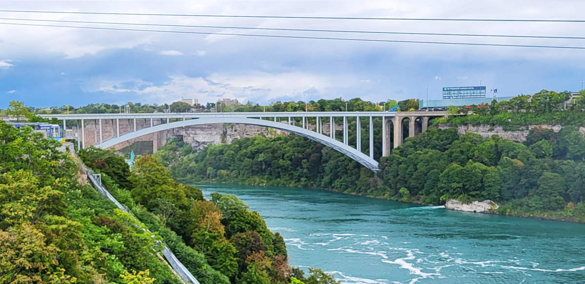
Honeymoon Bridge
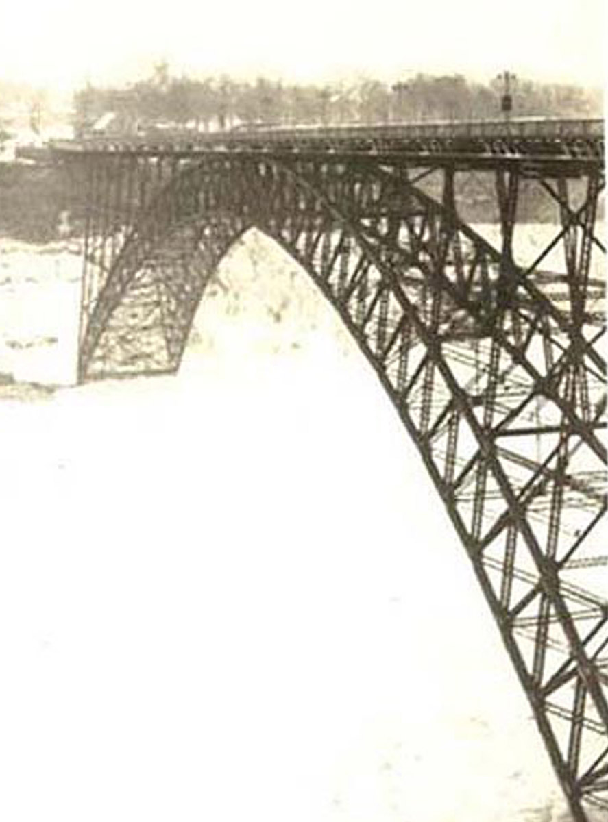
ca. 1910s
This is the Honeymoon Bridge before it collapsed in 1938.
Honeymoon Bridge Collapses
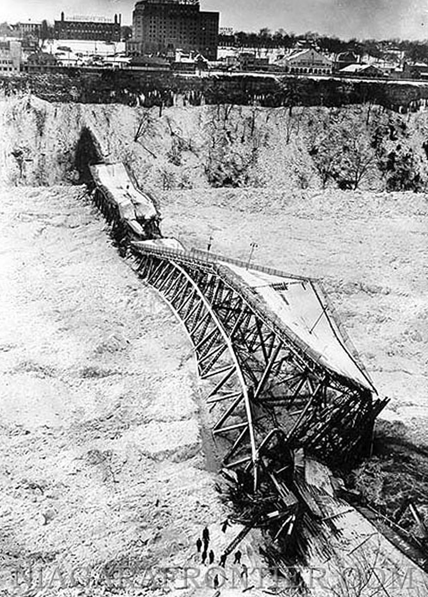
1938
The Honeymoon Bridge was built in 1897 and connected the American and Canadian shores at Niagara Falls. Huge ice floes colliding with the abutments nearly destroyed the bridge in 1899, shortly after it was constructed. The bridge was heavily reinforced, and these supports helped the bridge hold for 40 years, until the day this photo was taken.
On January 27, 1938 a huge wind storm on Lake Erie pushed a gigantic amount of ice over the falls. It collided with the bridge and caused a huge buildup, slowly pushing the bridge over. Thousands of onlookers had gathered to watch the bridge collapse, when it finally did so at 4:20 pm. It took a few months for all the bridge's remnants to be removed, and some time more for a replacement to be built.