Partner City
Camrose
City of Roses
Camrose is the traditional territory of several Indigenous groups who travelled across the prairie. The land where Camrose sits was well-traversed by the Cree who set up camps throughout the region following seasonal hunting routes. To the south of Camrose was the territory of the Niitsitapi (Blackfoot), the traditional enemies of the Cree, and the two groups frequently fought. Battle River, south of Camrose, was a natural boundary between Cree and Niitsitapi territories, and was named for the battles between them. The first settlers to arrive in the area were fur traders who exploited the abundant fur-bearing mammals of the area. Despite this abundance, there were no trading posts in the Camrose area and traders mostly gathered furs here on their way to posts elsewhere. Settlement did not begin in the area until the Dominion Lands Act was passed in 1872, granting lands in the west to settlers for homesteading. Many early homesteaders were immigrants from Sweden and or Norway, and skiing was a popular pastime as the terrain of Camrose was perfectly suited to cross-country skiing. Ole Bakken, the first homesteader on the present site of Camrose was originally from Norway, and owned many of the first lots in the townsite. Camrose was first known as Stoney Creek, then Sparling, until the town incorporated in 1906 under the name "Camrose". A new name was chosen as Sparling was similar enough to Sperling, Manitoba, and Sterling, Alberta that postal authorities became confused. The town grew swiftly after the Canadian Pacific Railway extended its line from Wetaskiwin. Later, the Grand Trunk Railway and the Canadian Northern Railway also reached Camrose, bringing tri-weekly mail and passenger service. While the fertile soil and high precipitation made Camrose ideal for agriculture, the confluence of many railways made transportation convenient and the city grew swiftly. Today, tourism has emerged as one of the city's primary industries as visitors take advantage of the Camrose's many parks and opportunities for recreation.
We honour and acknowledge the traditional lands of Treaty 6 upon which Camrose is located. This is the traditional territory of the Maskwacis Nêhiyawak, Niitsitapi, Nakoda, and Tsuut'ina Nations, as well as the Métis. Indigenous Peoples have called this land home since time immemorial.


Explore
Camrose
Then and Now Photos
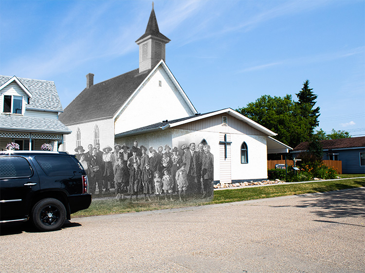
Camrose Parade
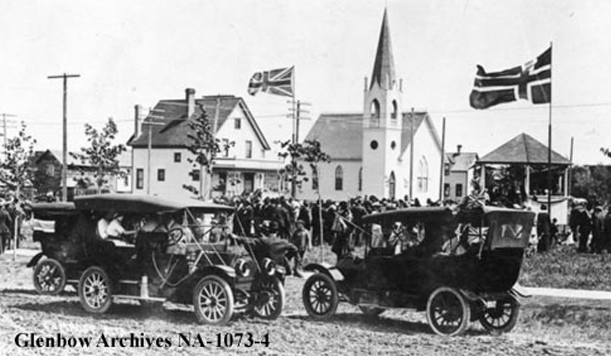
May 24, 1915
Camrose celebrates an event with a large crowd on May 24th 1915. Three cars are visible in the foreground with passengers flying flags out the window, while a large crowd assembles outside Presbyterian church in the background. Two large flags fly above the gathering: The Norwegian flag and the Union Jack.
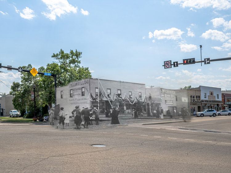
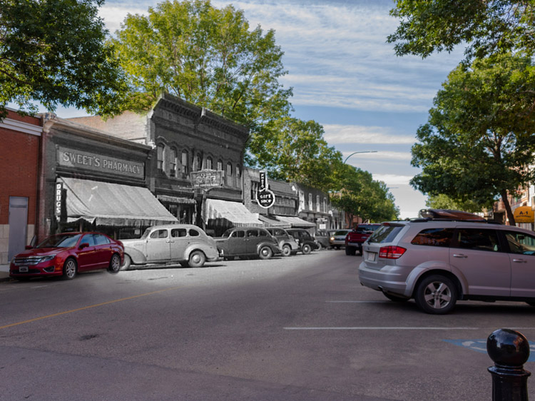
Shops and Stores
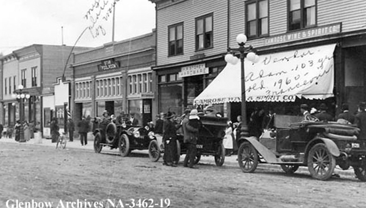
Ca. 1910-1915
A close up view of some businesses on Main Street. Automobiles and bicycles are parked at the kerb. From left to right, you can see a barber shop, Star Pool room, a hardware store and the Camrose Wine and Spirit Company.
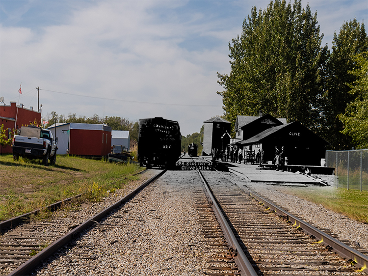
A Crowded Street
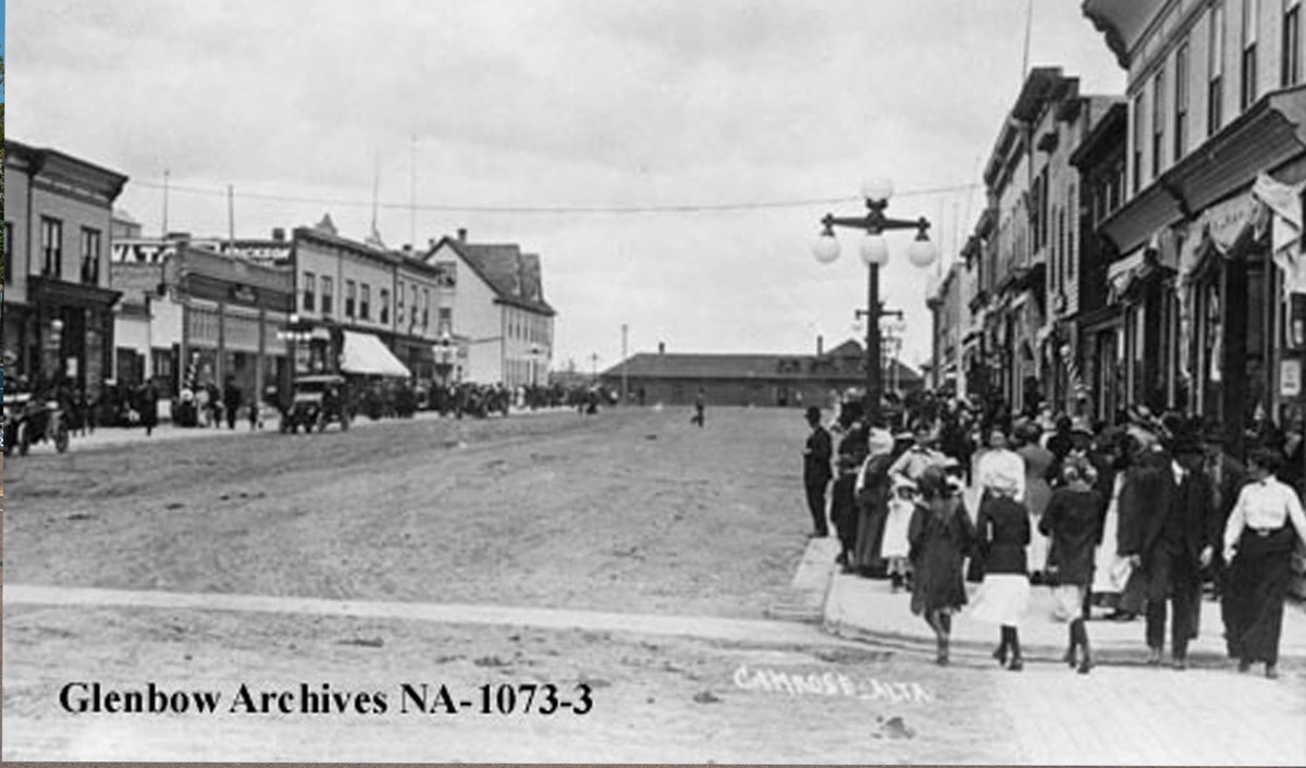
Ca. 1915
Crowds of pedestrians fill the sidewalks on Camrose's Main Street. The CPR station is visible at the end of the road.
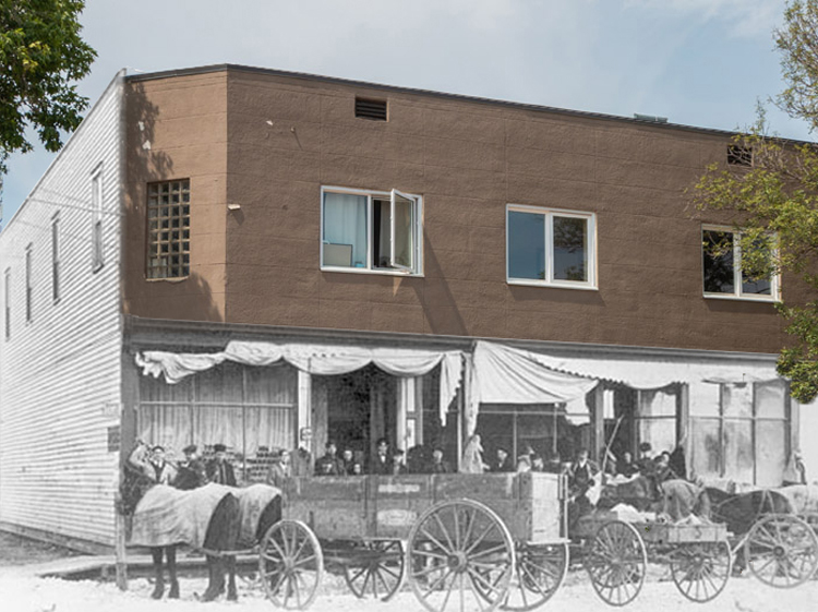
The Traders Bank
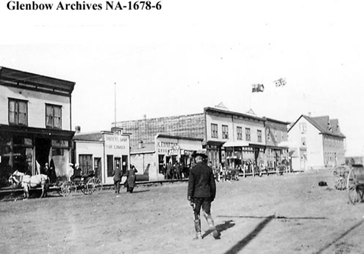
ca. 1912-1916
A view of Main Street in the mid 1910s. Horses and buggies line the street, while a man crosses in front of the camera. On the left side of the street is the Traders Bank, which amalgamated with the Merchants Bank in 1912.
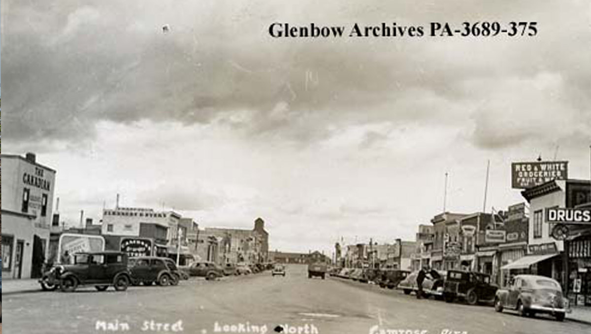
The Main Drag
Ca. 1930
Main Street looking North. You can compare this photo to "Looking North on Main", which was taken from the same angle 10 years later. The street looks remarkably similar, with the drug store, grocery, grain elevator and CPR station all unchanged.
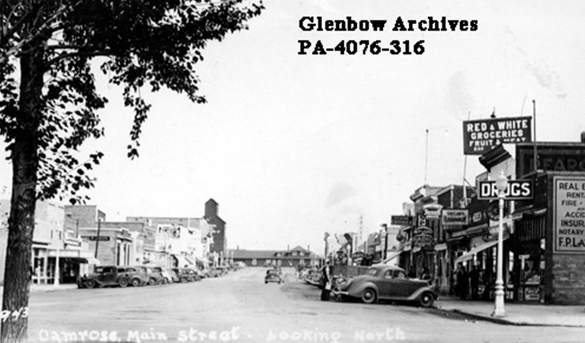
Looking North on Main
Ca. 1940
A postcard view looking north up Main Street. Cars are parallel parked on the sides of the street in front of businesses. A drug store is visible on the right, with the Red and White Groceries just behind. A grain elevator and the Canadian Pacific Railway station are visible in the background.